MyTopo
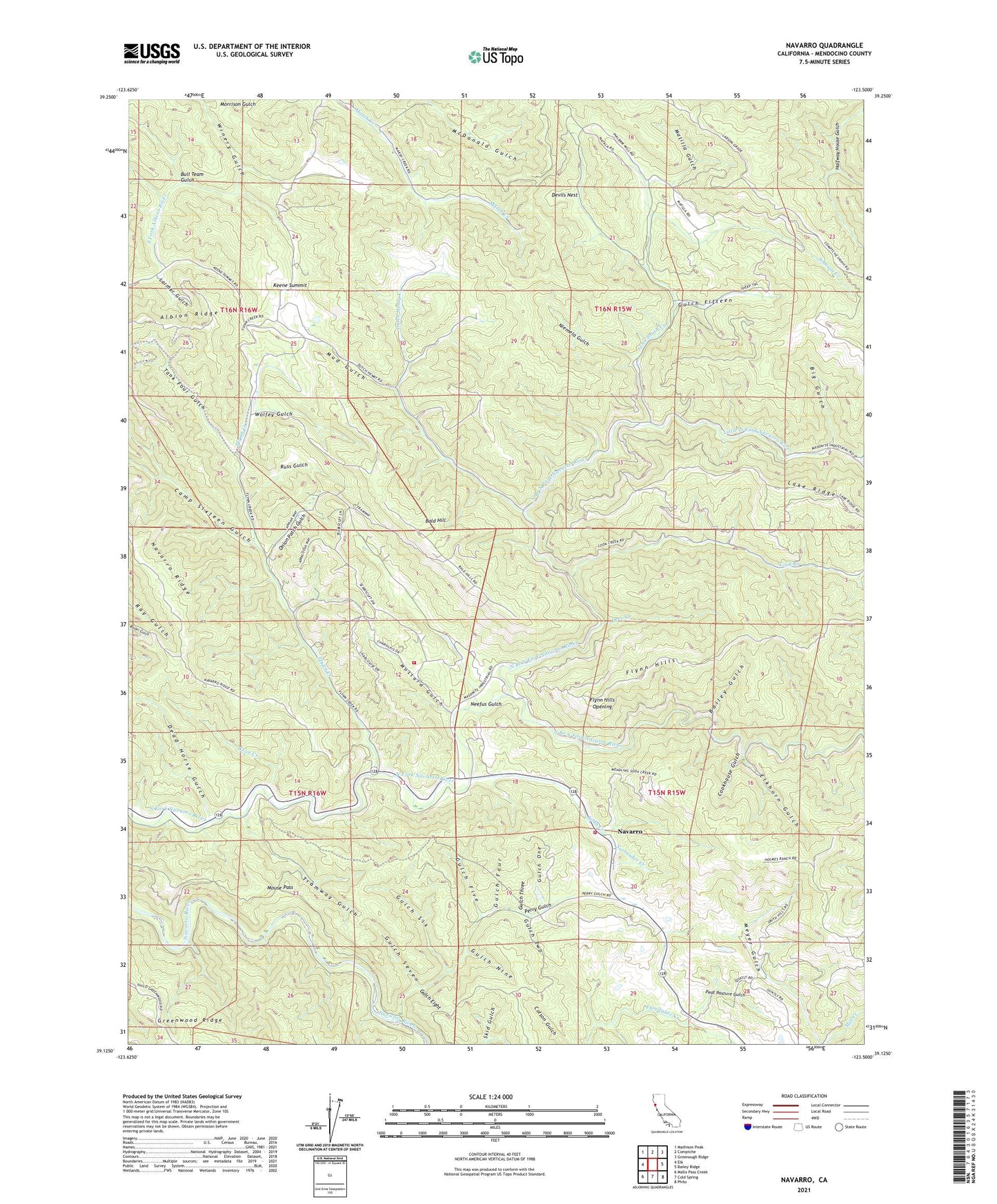
Navarro California US Topo Map
Couldn't load pickup availability
2021 topographic map quadrangle Navarro in the state of California. Scale: 1:24000. Based on the newly updated USGS 7.5' US Topo map series, this map is in the following counties: Mendocino. The map contains contour data, water features, and other items you are used to seeing on USGS maps, but also has updated roads and other features. This is the next generation of topographic maps. Printed on high-quality waterproof paper with UV fade-resistant inks.
Quads adjacent to this one:
West: Elk
Northwest: Mathison Peak
North: Comptche
Northeast: Greenough Ridge
East: Bailey Ridge
Southeast: Philo
South: Cold Spring
Southwest: Mallo Pass Creek
This map covers the same area as the classic USGS quad with code o39123b5.
Contains the following named places: Anderson Valley Volunteer Fire Department Station 743, Anderson Valley Volunteer Fire Station, Bailey Gulch, Bald Hill, Big Gulch, Blossom School, Bull Team Gulch, Camp Navarro, Camp Sixteen Gulch, Cook Creek, Cookhouse Gulch, Coon Creek, Dead Horse Gulch, Deer Creek, Devils Nest, Dutch Henry Creek, Elkhorn Gulch, Flynn Creek, Flynn Hills, Flynn Hills Opening, Gulch Eight, Gulch Fifteen, Gulch Five, Gulch Four, Gulch Nine, Gulch One, Gulch Seven, Gulch Six, Gulch Three, Gulch Two, Halfway House Gulch, Hansen School, Ingram Ranch, John Smith Creek, Johnson Creek, Keene Summit, Lake Ridge, Larmer Gulch, Little North Fork Navarro River, Matilla Gulch, Mendocino Division, Mouse Pass, Mud Gulch, Mustard Gulch, Navarro, Neefus Gulch, Niemela Gulch, North Branch North Fork Navarro River, Onion Patch Gulch, Peat Pasture Gulch, Perry Gulch, Redwood Creek, Royale Redwoods Ranch, Russ Gulch, Sheep Trail, Soda Creek, South Branch North Fork Navarro River, Surrender Creek, Tank Four Gulch, Tramway Gulch, Winery Gulch, Wolfey Gulch, ZIP Codes: 95427, 95463