MyTopo
Mettler California US Topo Map
Couldn't load pickup availability
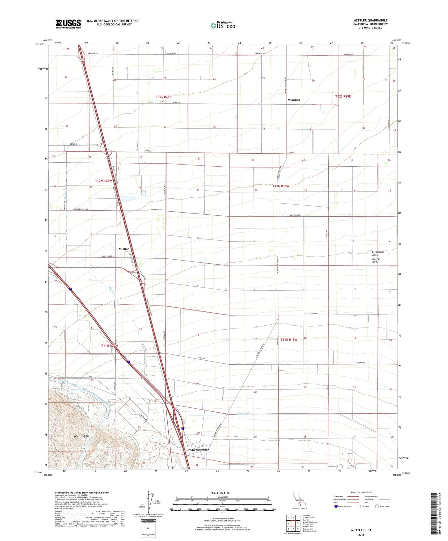
2021 topographic map quadrangle Mettler in the state of California. Scale: 1:24000. Based on the newly updated USGS 7.5' US Topo map series, this map is in the following counties: Kern. The map contains contour data, water features, and other items you are used to seeing on USGS maps, but also has updated roads and other features. This is the next generation of topographic maps. Printed on high-quality waterproof paper with UV fade-resistant inks.
Quads adjacent to this one:
West: Coal Oil Canyon
Northwest: Conner
North: Weed Patch
Northeast: Arvin
East: Tejon Hills
Southeast: Pastoria Creek
South: Grapevine
Southwest: Pleito Hills
This map covers the same area as the classic USGS quad with code o35118a8.
Contains the following named places: Grapevine Creek, Ira J Chrisman Wind Gap Pumping Plant, KNOB-AM (Frazier Park), Meridian, Meridian School, Mettler, Mettler Census Designated Place, Mettler Elementary School, Salt Creek, Tejon Substation, Wheeler Ridge