MyTopo
Coal Oil Canyon California US Topo Map
Couldn't load pickup availability
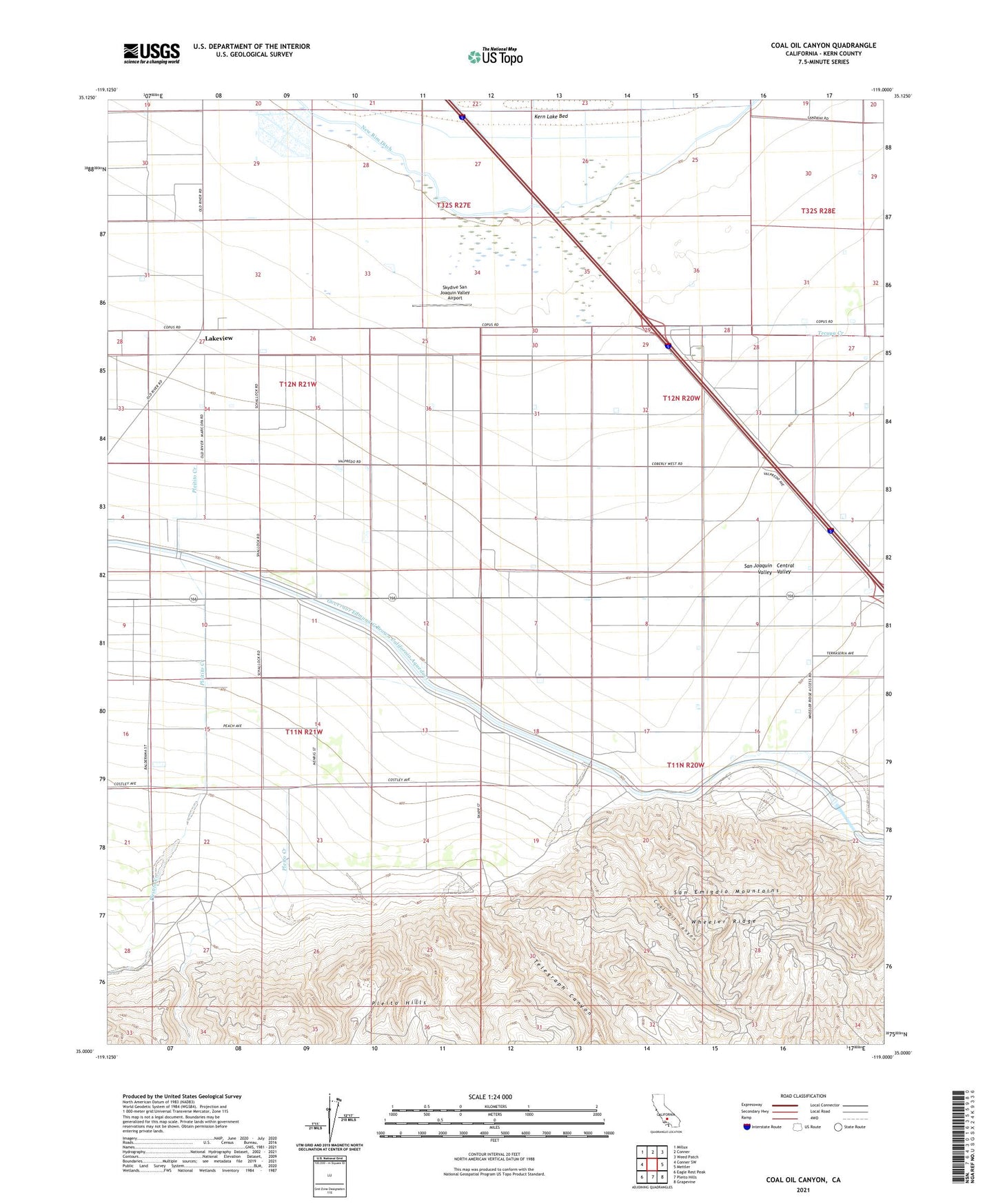
2021 topographic map quadrangle Coal Oil Canyon in the state of California. Scale: 1:24000. Based on the newly updated USGS 7.5' US Topo map series, this map is in the following counties: Kern. The map contains contour data, water features, and other items you are used to seeing on USGS maps, but also has updated roads and other features. This is the next generation of topographic maps. Printed on high-quality waterproof paper with UV fade-resistant inks.
Quads adjacent to this one:
West: Conner SW
Northwest: Millux
North: Conner
Northeast: Weed Patch
East: Mettler
Southeast: Grapevine
South: Pleito Hills
Southwest: Eagle Rest Peak
This map covers the same area as the classic USGS quad with code o35119a1.
Contains the following named places: Coal Oil Canyon, Emidio Pumping Station, Fages-Zalvidea Trails Marker, John R Teerink Wheeler Ridge Punping Plant, Lakeview, Lakeview Duck Club, New Rim Ditch, Panama Migratory School, Pleitito Creek, Pleito Creek, Pleito Ranch, San Emigdio, Skydive San Joaquin Valley Airport, Tecuya Creek, Telegraph Canyon, Wheeler Ridge, Wheeler Ridge Oil Field