
MyTopo
Milford California US Topo Map
Couldn't load pickup availability
Also explore the Milford Forest Service Topo of this same quad for updated USFS data
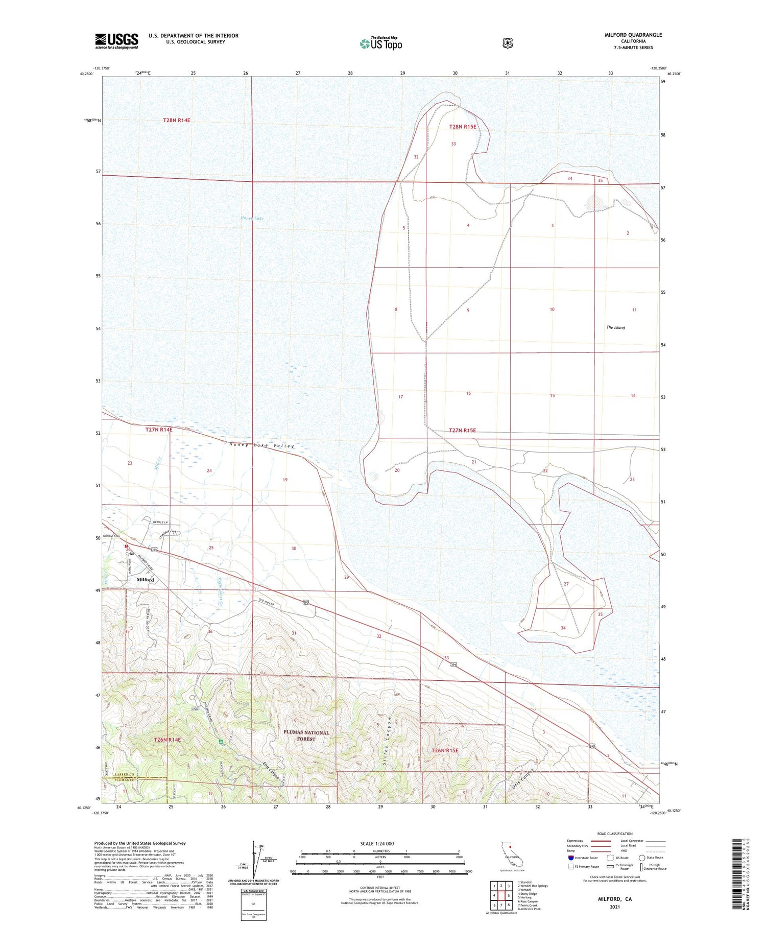
2021 topographic map quadrangle Milford in the state of California. Scale: 1:24000. Based on the newly updated USGS 7.5' US Topo map series, this map is in the following counties: Lassen, Plumas. The map contains contour data, water features, and other items you are used to seeing on USGS maps, but also has updated roads and other features. This is the next generation of topographic maps. Printed on high-quality waterproof paper with UV fade-resistant inks.
Quads adjacent to this one:
West: Stony Ridge
Northwest: Standish
North: Wendel Hot Springs
Northeast: Wendel
East: Herlong
Southeast: McKesick Peak
South: Ferris Creek
Southwest: Ross Canyon
This map covers the same area as the classic USGS quad with code o40120b3.
Contains the following named places: Corona Mine, East Canyon, Honey Lake, Honey Lake Mine, Honey Lake Pit, Laufman Campground, Laufman Ranger Station, McDermott Creek, Milford, Milford Census Designated Place, Milford Fire District, Milford Post Office, Mill Creek, Otis Canyon, Stiles Canyon, The Island


