MyTopo
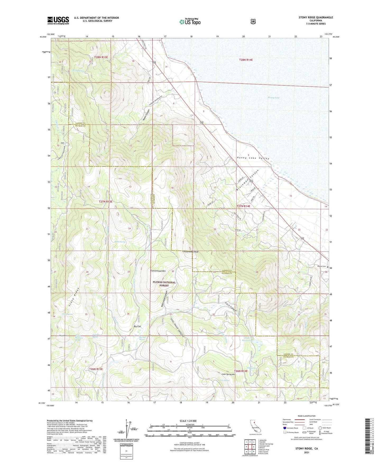
Stony Ridge California US Topo Map
Couldn't load pickup availability
Also explore the Stony Ridge Forest Service Topo of this same quad for updated USFS data
2021 topographic map quadrangle Stony Ridge in the state of California. Scale: 1:24000. Based on the newly updated USGS 7.5' US Topo map series, this map is in the following counties: Lassen, Plumas. The map contains contour data, water features, and other items you are used to seeing on USGS maps, but also has updated roads and other features. This is the next generation of topographic maps. Printed on high-quality waterproof paper with UV fade-resistant inks.
Quads adjacent to this one:
West: Antelope Lake
Northwest: Janesville
North: Standish
Northeast: Wendel Hot Springs
East: Milford
Southeast: Ferris Creek
South: Ross Canyon
Southwest: Babcock Peak
This map covers the same area as the classic USGS quad with code o40120b4.
Contains the following named places: Bell Spring, Big Flat, Big Flat Spring, Brockman Canyon, Cedar Spring, Clark Ranch, Cottonwood Creek, Cottonwood Mountain, Cottonwood Peak, Dinky Spring, Doyle Reservoir, Fitch Canyon, Juniper Spring, Left Hand Canyon, Lone Spring, Lone Spring Mountain, Milford Cemetery, Right Hand Canyon, Round Mountain, Round Mountain Spring, Stony Creek, Stony Ridge, Wales Canyon, ZIP Code: 96121