MyTopo
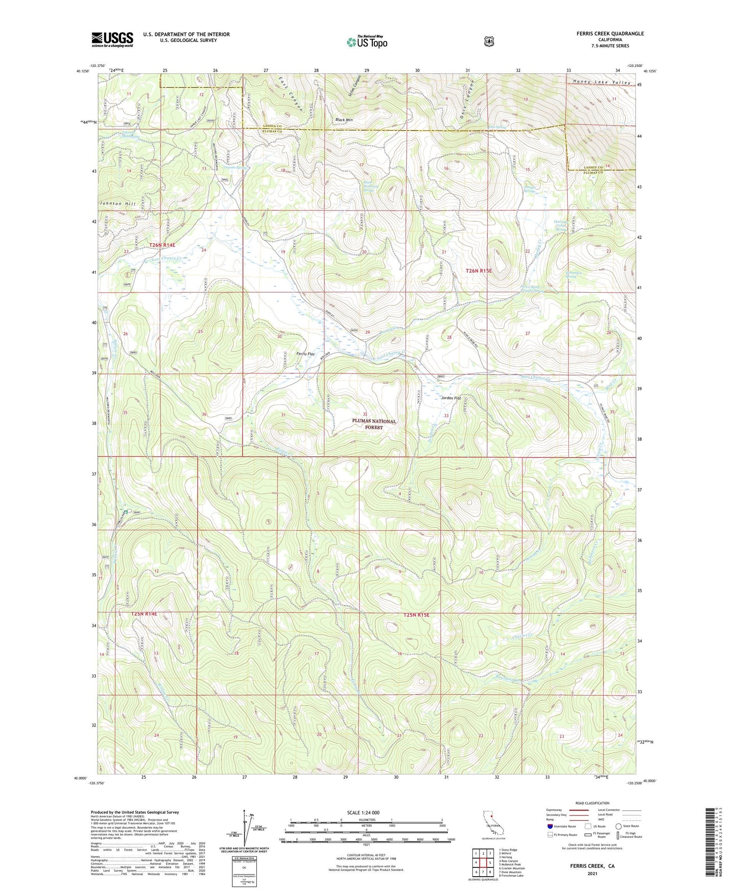
Ferris Creek California US Topo Map
Couldn't load pickup availability
Also explore the Ferris Creek Forest Service Topo of this same quad for updated USFS data
2021 topographic map quadrangle Ferris Creek in the state of California. Scale: 1:24000. Based on the newly updated USGS 7.5' US Topo map series, this map is in the following counties: Plumas, Lassen. The map contains contour data, water features, and other items you are used to seeing on USGS maps, but also has updated roads and other features. This is the next generation of topographic maps. Printed on high-quality waterproof paper with UV fade-resistant inks.
Quads adjacent to this one:
West: Ross Canyon
Northwest: Stony Ridge
North: Milford
Northeast: Herlong
East: McKesick Peak
Southeast: Frenchman Lake
South: Dixie Mountain
Southwest: Crocker Mountain
This map covers the same area as the classic USGS quad with code o40120a3.
Contains the following named places: Artray Creek, Bird Creek, Black Mountain, Black Mountain Spring, Conklin Park Campground, Dooley Creek, Downing Cabin, Downing Cabin Spring, Eagle Rock Mine, Ferris Creek, Ferris Flat, Granite Spring, Grey Goose Mine, Horseshoe Spring, Johnson Hill, Johnson Mill Spring, Jordan Creek, Jordan Flat, Juniper Spring, Otis Spring, Plinco Mine, Plinco Sheep Troughs Spring, Robinson Creek, State Game Refuge One-P