MyTopo
West Ord Mountain California US Topo Map
Couldn't load pickup availability
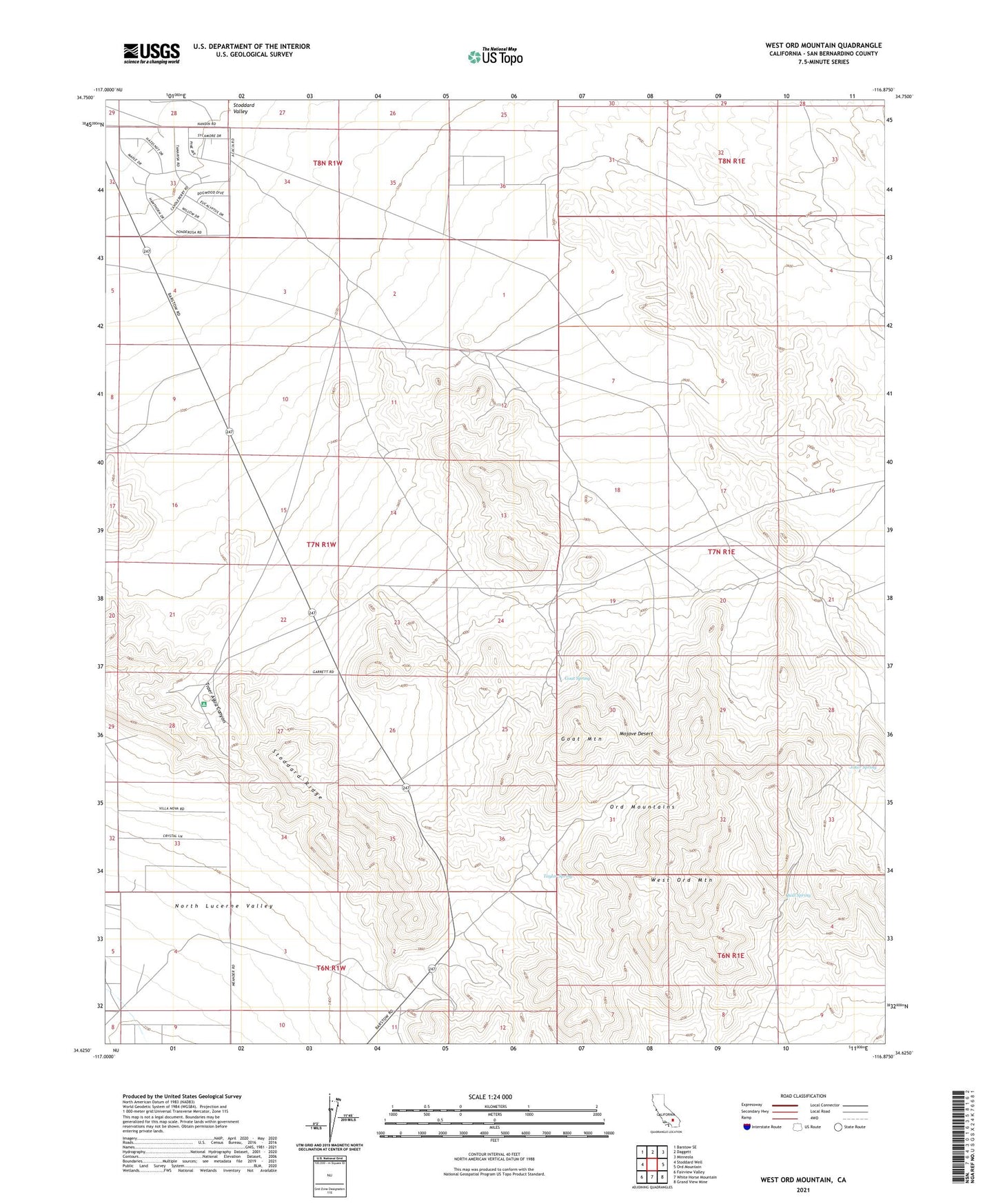
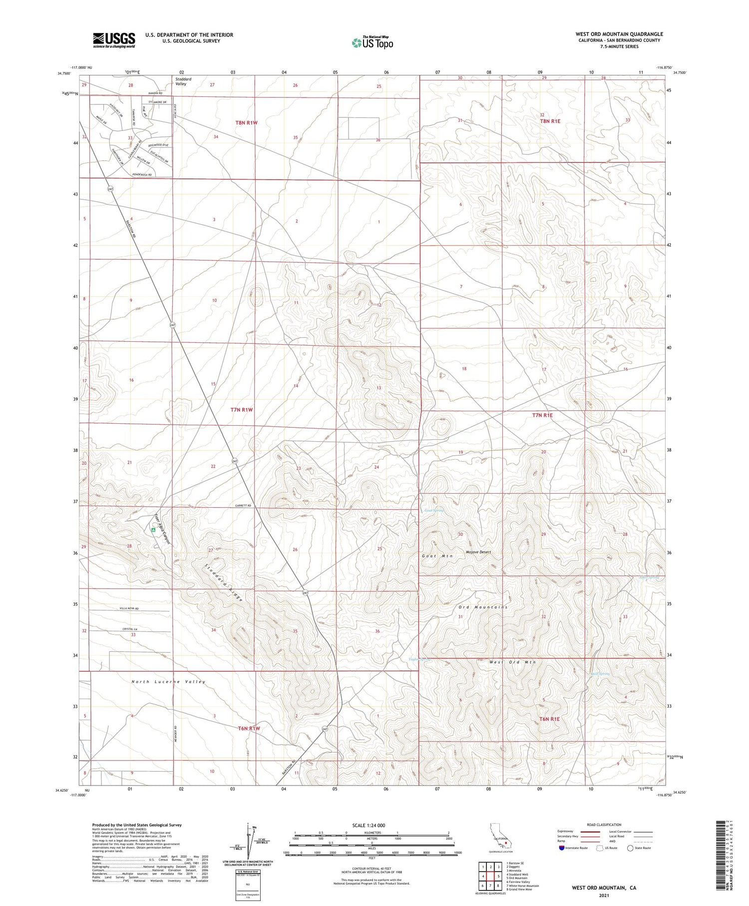
2021 topographic map quadrangle West Ord Mountain in the state of California. Scale: 1:24000. Based on the newly updated USGS 7.5' US Topo map series, this map is in the following counties: San Bernardino. The map contains contour data, water features, and other items you are used to seeing on USGS maps, but also has updated roads and other features. This is the next generation of topographic maps. Printed on high-quality waterproof paper with UV fade-resistant inks.
Quads adjacent to this one:
West: Stoddard Well
Northwest: Barstow SE
North: Daggett
Northeast: Minneola
East: Ord Mountain
Southeast: Grand View Mine
South: White Horse Mountain
Southwest: Fairview Valley
This map covers the same area as the classic USGS quad with code o34116f8.
Contains the following named places: Anita Mine, Cline Microwave Relay Station, Foster Well, Goat Mountain, Goat Spring, Gold Belt Mine, Granite Well, Joker Spring, New Deal Mine, Ord Mountains, Quill Mine, Quill Spring, Taylor Spring, Traer Agua Canyon, West Ord Mountain