MyTopo
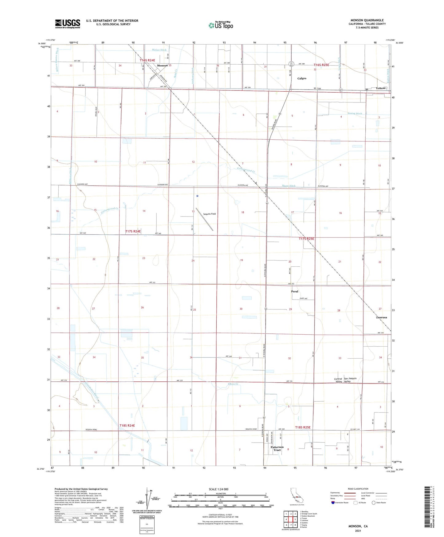
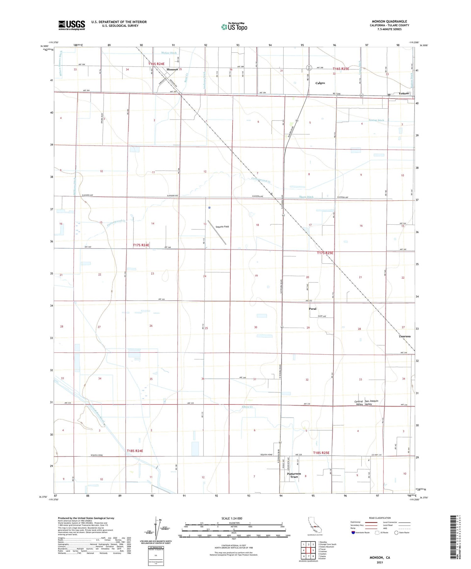
Monson California US Topo Map
Couldn't load pickup availability
2021 topographic map quadrangle Monson in the state of California. Scale: 1:24000. Based on the newly updated USGS 7.5' US Topo map series, this map is in the following counties: Tulare. The map contains contour data, water features, and other items you are used to seeing on USGS maps, but also has updated roads and other features. This is the next generation of topographic maps. Printed on high-quality waterproof paper with UV fade-resistant inks.
Quads adjacent to this one:
West: Traver
Northwest: Reedley
North: Orange Cove South
Northeast: Stokes Mountain
East: Ivanhoe
Southeast: Exeter
South: Visalia
Southwest: Goshen
This map covers the same area as the classic USGS quad with code o36119d3.
Contains the following named places: B and D Dairy, Bosman Dairy, Button Ditch, Calgro, Chatham School, Elbow Creek Dairy, Elbow Creek School, Elkhorn Dairy, Gilbert Aviation Heliport, KFRE-AM (Fresno), KRDU-AM (Dinuba), Milk Maid Dairy, Milky Way Dairy, Mineral King Dairy, Monson, Monson Census Designated Place, Nunes Brothers Dairy, Patterson Tract Census Designated Place, Peral, Red Rose Dairy, Saint Maries Church, Sand Creek, Sequoia Field, Sequoia Home, Sharp Ditch, Taurusa, Taurusa School, Tulare County Sheriff Agricultural / Rural Crimes, Tulare County Sheriff's Office, Van Ryn Dairy, Williams Ditch, Wilson Hunter Ditch, Yettem, Yettem Census Designated Place, Yettem Post Office, ZIP Code: 93291