MyTopo
Ivanhoe California US Topo Map
Couldn't load pickup availability
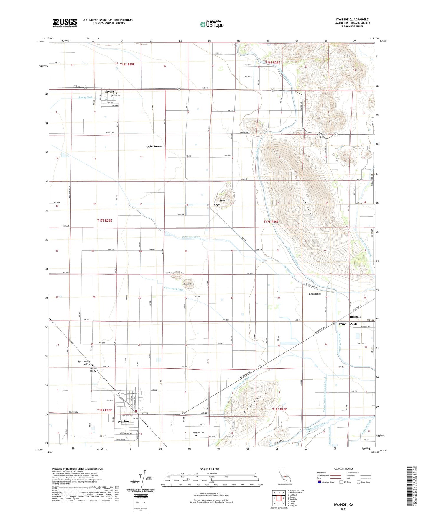
2021 topographic map quadrangle Ivanhoe in the state of California. Scale: 1:24000. Based on the newly updated USGS 7.5' US Topo map series, this map is in the following counties: Tulare. The map contains contour data, water features, and other items you are used to seeing on USGS maps, but also has updated roads and other features. This is the next generation of topographic maps. Printed on high-quality waterproof paper with UV fade-resistant inks.
Quads adjacent to this one:
West: Monson
Northwest: Orange Cove South
North: Stokes Mountain
Northeast: Auckland
East: Woodlake
Southeast: Rocky Hill
South: Exeter
Southwest: Visalia
This map covers the same area as the classic USGS quad with code o36119d2.
Contains the following named places: Bacon Hill, Cairns, Colvin Mountain, Colvin Ranch, Cottonwood Ditch, Hillmaid, Ivanhoe, Ivanhoe Census Designated Place, Ivanhoe Division, Ivanhoe Elementary School, Ivanhoe Post Office, Lone Oak Cemetery, Mountain View Dairy, Mud Spring Gap, Paloma School, Rayo, Redbanks, Seville, Seville Census Designated Place, Sontag Ditch, Stone Corral Elementary School, Stone Corral School, Tulare County Fire Department Battalion 1 Ivanhoe Fire Station 8, Tulare Irrigation District Canal, Twin Buttes, Venice Hills, Wutchumna Ditch, ZIP Codes: 93235, 93292