MyTopo
Stokes Mountain California US Topo Map
Couldn't load pickup availability
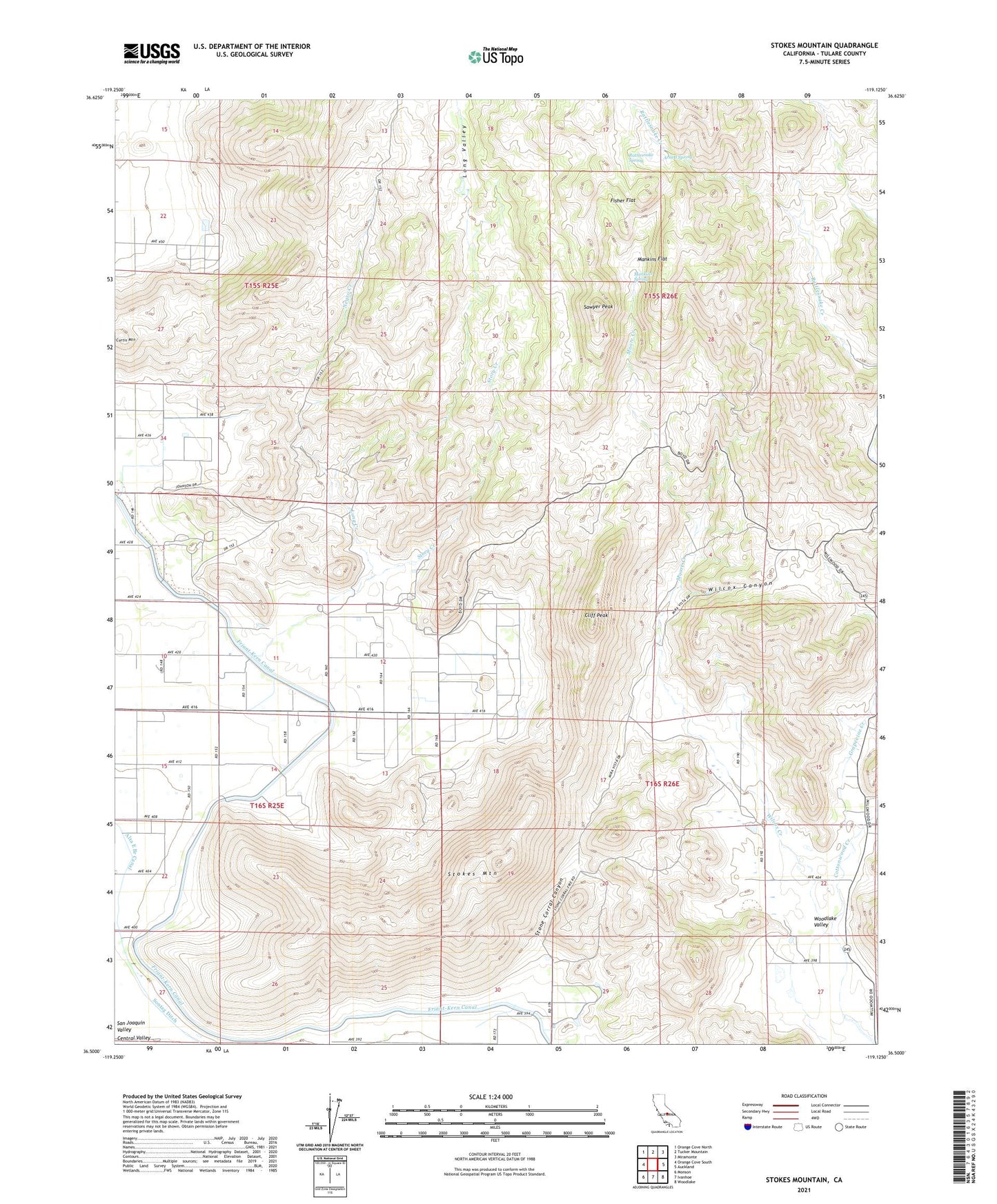
2021 topographic map quadrangle Stokes Mountain in the state of California. Scale: 1:24000. Based on the newly updated USGS 7.5' US Topo map series, this map is in the following counties: Tulare. The map contains contour data, water features, and other items you are used to seeing on USGS maps, but also has updated roads and other features. This is the next generation of topographic maps. Printed on high-quality waterproof paper with UV fade-resistant inks.
Quads adjacent to this one:
West: Orange Cove South
Northwest: Orange Cove North
North: Tucker Mountain
Northeast: Miramonte
East: Auckland
Southeast: Woodlake
South: Ivanhoe
Southwest: Monson
Contains the following named places: Arnett Spring, Cliff Peak, Dixie Ranch, Elda School, Fisher Flat, Grapevine Creek, Jackson Ranch, Ledbetter Borrow Pit, Long Creek, Long Valley, Mankins Flat, Mankins Spring, Moore Creek, Moore Creek Ranch, Negro Creek, Rattlesnake Spring, Sawyer Peak, Stokes Mountain, Stone Corral Canyon, Story Creek, Wilcox Canyon, Wilcox Creek, Wilcox School, Wimp, Woodlake Valley, ZIP Code: 93647