MyTopo
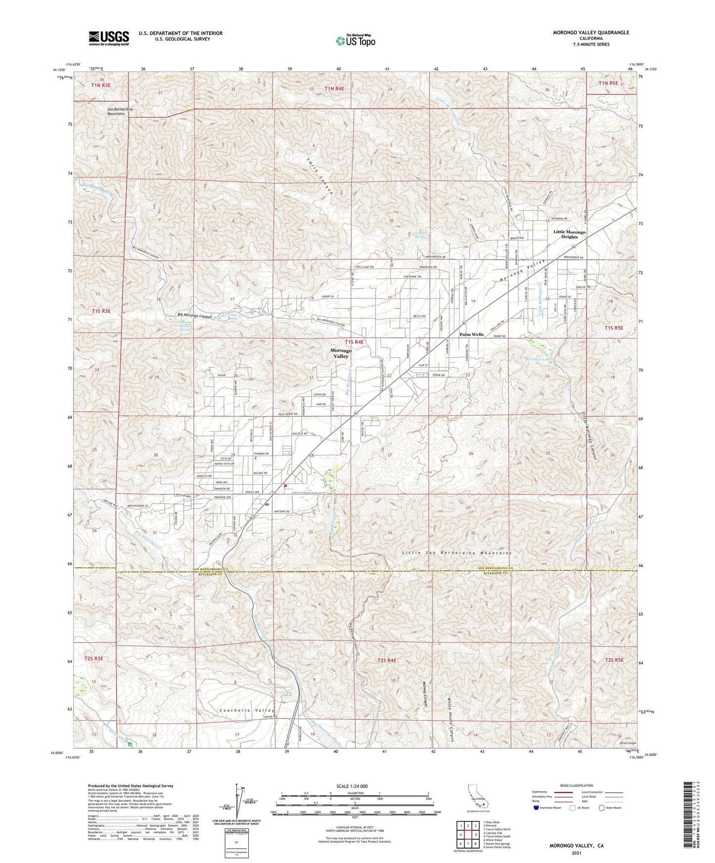
Morongo Valley California US Topo Map
Couldn't load pickup availability
Also explore the Morongo Valley Forest Service Topo of this same quad for updated USFS data
2021 topographic map quadrangle Morongo Valley in the state of California. Scale: 1:24000. Based on the newly updated USGS 7.5' US Topo map series, this map is in the following counties: San Bernardino, Riverside. The map contains contour data, water features, and other items you are used to seeing on USGS maps, but also has updated roads and other features. This is the next generation of topographic maps. Printed on high-quality waterproof paper with UV fade-resistant inks.
Quads adjacent to this one:
West: Catclaw Flat
Northwest: Onyx Peak
North: Rimrock
Northeast: Yucca Valley North
East: Yucca Valley South
Southeast: Seven Palms Valley
South: Desert Hot Springs
Southwest: White Water
This map covers the same area as the classic USGS quad with code o34116a5.
Contains the following named places: Big Morongo Canyon, Big Morongo Creek, Canyon House Ranch, Covington Park, Dry Morongo Creek, Leopard Spring, Little Morongo Heights, Morongo Lakes, Morongo Valley, Morongo Valley Census Designated Place, Morongo Valley Elementary School, Morongo Valley Fire Department Station 461, Morongo Valley Post Office, Palm Wells, Pierce Ranch, Sherman Shady Spring, Smith Canyon, T Cross K Ranch, ZIP Code: 92256