
MyTopo
Yucca Valley North California US Topo Map
Couldn't load pickup availability
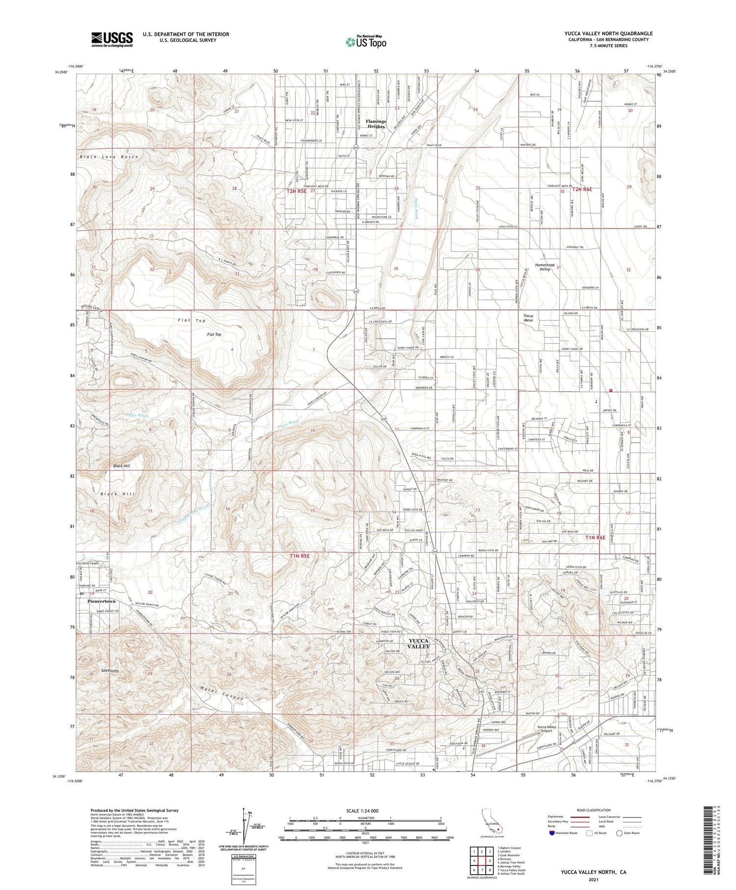
2021 topographic map quadrangle Yucca Valley North in the state of California. Scale: 1:24000. Based on the newly updated USGS 7.5' US Topo map series, this map is in the following counties: San Bernardino. The map contains contour data, water features, and other items you are used to seeing on USGS maps, but also has updated roads and other features. This is the next generation of topographic maps. Printed on high-quality waterproof paper with UV fade-resistant inks.
Quads adjacent to this one:
West: Rimrock
Northwest: Bighorn Canyon
North: Landers
Northeast: Goat Mountain
East: Joshua Tree North
Southeast: Joshua Tree South
South: Yucca Valley South
Southwest: Morongo Valley
This map covers the same area as the classic USGS quad with code o34116b4.
Contains the following named places: Black Hill, Calvary Baptist Church, Chaparrosa Wash, Church of the Nazarene, Desert Christ Park, First Christian Church, Flamingo Heights, Flat Top, Golden Rule Park, Hi-Desert Nature Museum, Joshua Village Shopping Center, Paradise Park, Pioneertown, Pioneertown Post Office, San Bernardino County Fire Department Yucca Valley Station 42, The Windmill, Warrens Well, Water Canyon, Yucca Mesa, Yucca Mesa Elementary School, Yucca Valley Airport, Yucca Valley Service Center Heliport, ZIP Code: 92284


