MyTopo
Rimrock California US Topo Map
Couldn't load pickup availability
Also explore the Rimrock Forest Service Topo of this same quad for updated USFS data
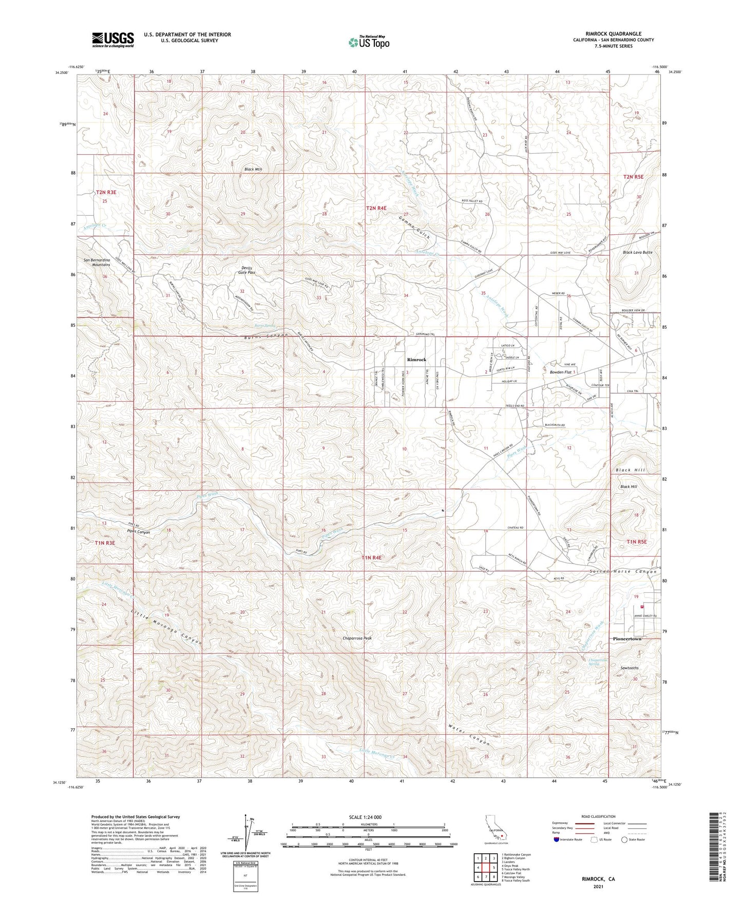
2021 topographic map quadrangle Rimrock in the state of California. Scale: 1:24000. Based on the newly updated USGS 7.5' US Topo map series, this map is in the following counties: San Bernardino. The map contains contour data, water features, and other items you are used to seeing on USGS maps, but also has updated roads and other features. This is the next generation of topographic maps. Printed on high-quality waterproof paper with UV fade-resistant inks.
Quads adjacent to this one:
West: Onyx Peak
Northwest: Rattlesnake Canyon
North: Bighorn Canyon
Northeast: Landers
East: Yucca Valley North
Southeast: Yucca Valley South
South: Morongo Valley
Southwest: Catclaw Flat
This map covers the same area as the classic USGS quad with code o34116b5.
Contains the following named places: Antelope Creek, Antelope Wash, Black Lava Butte, Black Mountain, Bobo Springs Reservoir, Bowden Flat, Burns Canyon, Burns Spring, Chaparrosa Peak, Chaparrosa Spring, Devils Gate Pass, Gamma Gulch, Kee Ranch, Pipes Canyon, Rimrock, San Bernardino County Fire Department Station 38 Pioneertown, Sawtooths, Sorrel Horse Canyon, The Pipes, The Pipes Ranch, ZIP Code: 92268