MyTopo
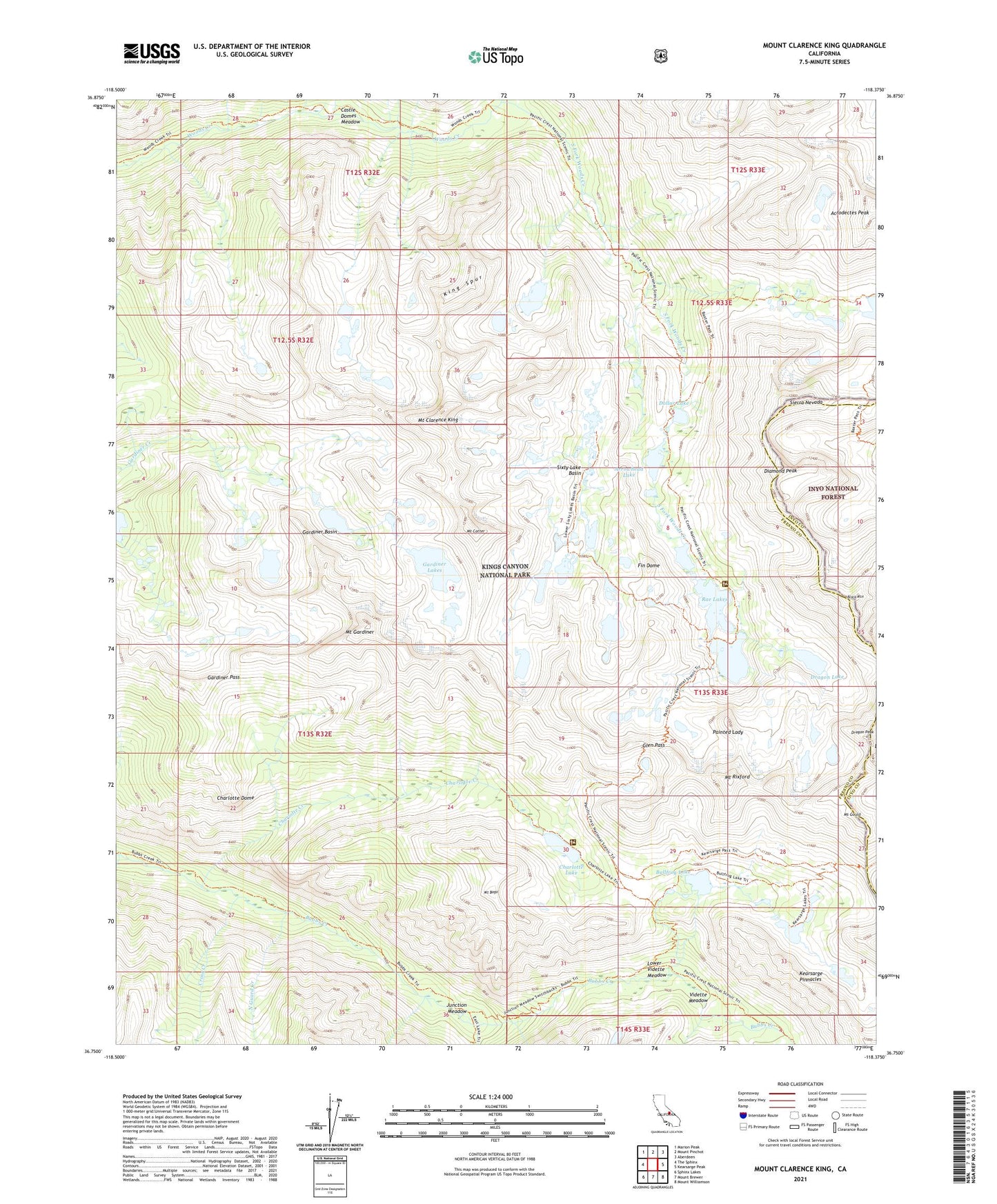
Mount Clarence King California US Topo Map
Couldn't load pickup availability
Also explore the Mount Clarence King Forest Service Topo of this same quad for updated USFS data
2021 topographic map quadrangle Mount Clarence King in the state of California. Scale: 1:24000. Based on the newly updated USGS 7.5' US Topo map series, this map is in the following counties: Fresno, Inyo. The map contains contour data, water features, and other items you are used to seeing on USGS maps, but also has updated roads and other features. This is the next generation of topographic maps. Printed on high-quality waterproof paper with UV fade-resistant inks.
Quads adjacent to this one:
West: The Sphinx
Northwest: Marion Peak
North: Mount Pinchot
Northeast: Aberdeen
East: Kearsarge Peak
Southeast: Mount Williamson
South: Mount Brewer
Southwest: Sphinx Lakes
This map covers the same area as the classic USGS quad with code o36118g4.
Contains the following named places: Acrodectes Peak, Arrowhead Lake, Baxter Creek, Baxter Lakes, Baxter Pass, Black Mountain, Bullfrog Lake, Castle Domes Meadow, Charlotte Creek, Charlotte Dome, Charlotte Lake, Cross Creek, Diamond Peak, Dollar Lake, Dragon Lake, Dragon Peak, East Creek, Fin Dome, Gardiner Basin, Gardiner Lakes, Gardiner Pass, Glen Pass, Junction Meadow, Kearsarge Pass, Kearsarge Pinnacles, King Spur, Lower Vidette Meadow, Mount Bago, Mount Clarence King, Mount Cotter, Mount Gardiner, Mount Gould, Mount Rixford, North Guard Creek, Painted Lady, Rae Lakes, Sixty Lake Basin, South Fork Woods Creek, Vidette Creek, Vidette Meadow