MyTopo
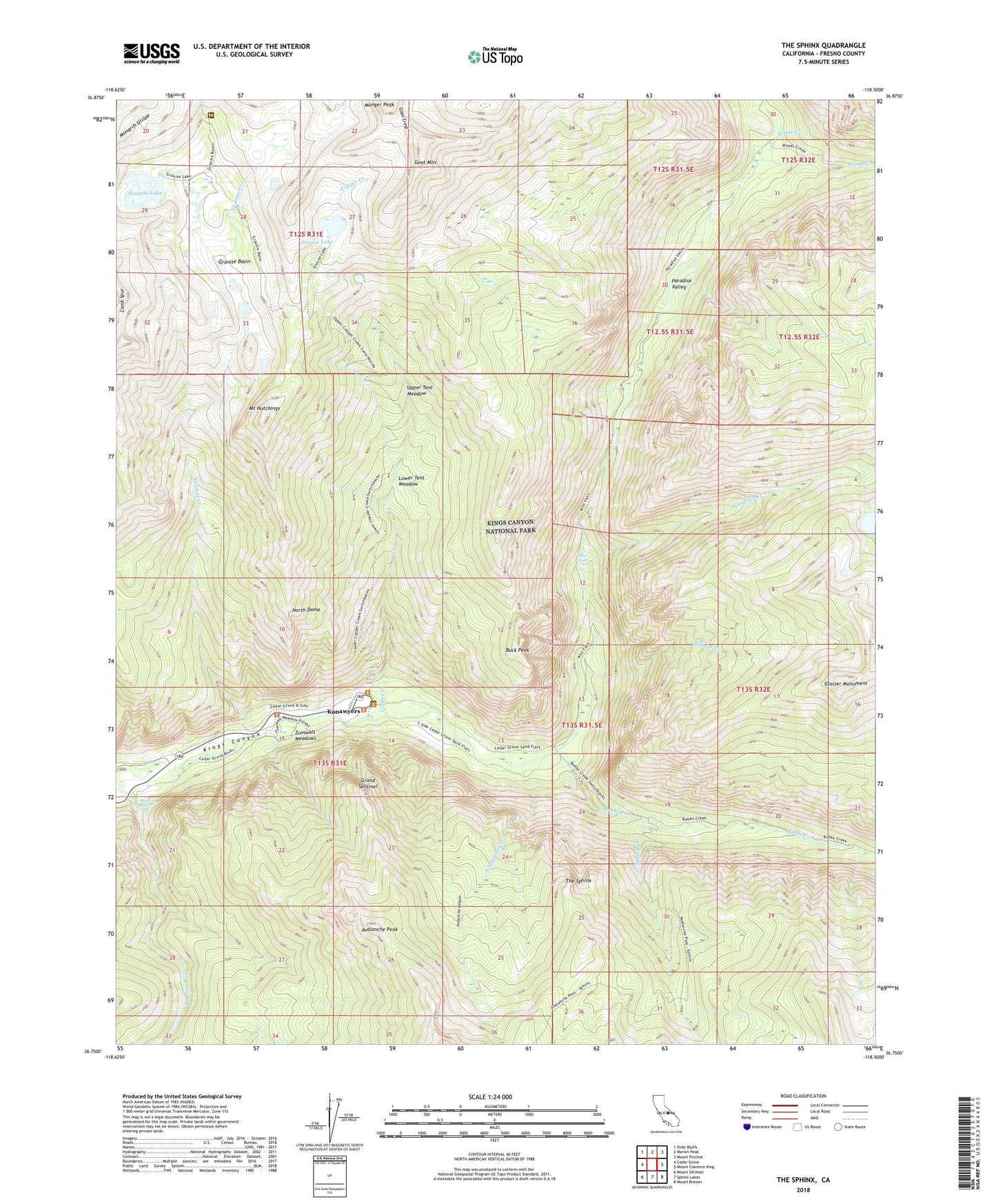
The Sphinx California US Topo Map
Couldn't load pickup availability
2021 topographic map quadrangle The Sphinx in the state of California. Scale: 1:24000. Based on the newly updated USGS 7.5' US Topo map series, this map is in the following counties: Fresno. The map contains contour data, water features, and other items you are used to seeing on USGS maps, but also has updated roads and other features. This is the next generation of topographic maps. Printed on high-quality waterproof paper with UV fade-resistant inks.
Quads adjacent to this one:
West: Cedar Grove
Northwest: Slide Bluffs
North: Marion Peak
Northeast: Mount Pinchot
East: Mount Clarence King
Southeast: Mount Brewer
South: Sphinx Lakes
Southwest: Mount Silliman
This map covers the same area as the classic USGS quad with code o36118g5.
Contains the following named places: Arrow Creek, Avalanche Canyon, Avalanche Creek, Avalanche Peak, Bubbs Creek, Buck Peak, Copper Creek, Gardiner Creek, Glacier Creek, Glacier Monument, Goat Crest, Goat Mountain, Grand Sentinel, Granite Basin, Granite Creek, Granite Lake, Grouse Lake, Kanawyers, Kings Wild and Scenic River, Lower Tent Meadow, Mist Falls, Mount Hutchings, Munger Peak, North Dome, Paradise Valley, Roaring River Falls, Sphinx Creek, Sugarloaf Creek, The Sphinx, Upper Tent Meadow, Woods Creek, Zumwalt Meadows