
MyTopo
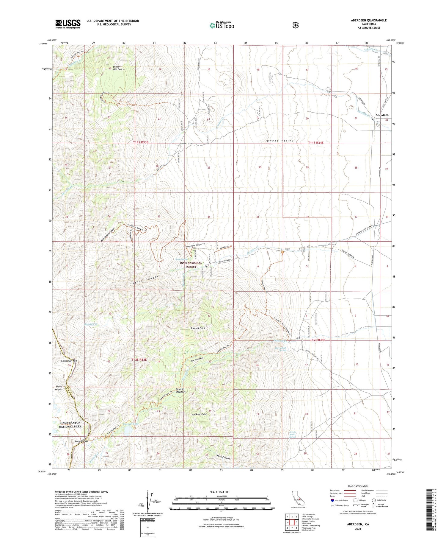
Aberdeen California US Topo Map
Couldn't load pickup availability
Also explore the Aberdeen Forest Service Topo of this same quad for updated USFS data
2021 topographic map quadrangle Aberdeen in the state of California. Scale: 1:24000. Based on the newly updated USGS 7.5' US Topo map series, this map is in the following counties: Inyo, Fresno. The map contains contour data, water features, and other items you are used to seeing on USGS maps, but also has updated roads and other features. This is the next generation of topographic maps. Printed on high-quality waterproof paper with UV fade-resistant inks.
Quads adjacent to this one:
West: Mount Pinchot
Northwest: Split Mountain
North: Fish Springs
Northeast: Tinemaha Reservoir
East: Blackrock
Southeast: Independence
South: Kearsarge Peak
Southwest: Mount Clarence King
This map covers the same area as the classic USGS quad with code o36118h3.
Contains the following named places: Aberdeen, Armstrong Canyon, Colosseum Mountain, Division Creek, Division Creek Powerhouse, Eightmile Ranch, Firecracker Mine, Glacier Mines, Goodale Creek Campground, Grover Anton Spring, Harry Birch Springs, Lookout Point, Mule Lake, Pinnacle Mine, Rudy Mine, Sawmill Creek Campground, Sawmill Lake, Sawmill Meadows, Sawmill Pass, Sawmill Pass Trailhead, Sawmill Point, Scotty Spring, Shingle Mill Bench, Sierra View Mine, Spook Canyon, Taboose Creek Campground, The Hogsback, Valley View Mine


