MyTopo
Mount George California US Topo Map
Couldn't load pickup availability
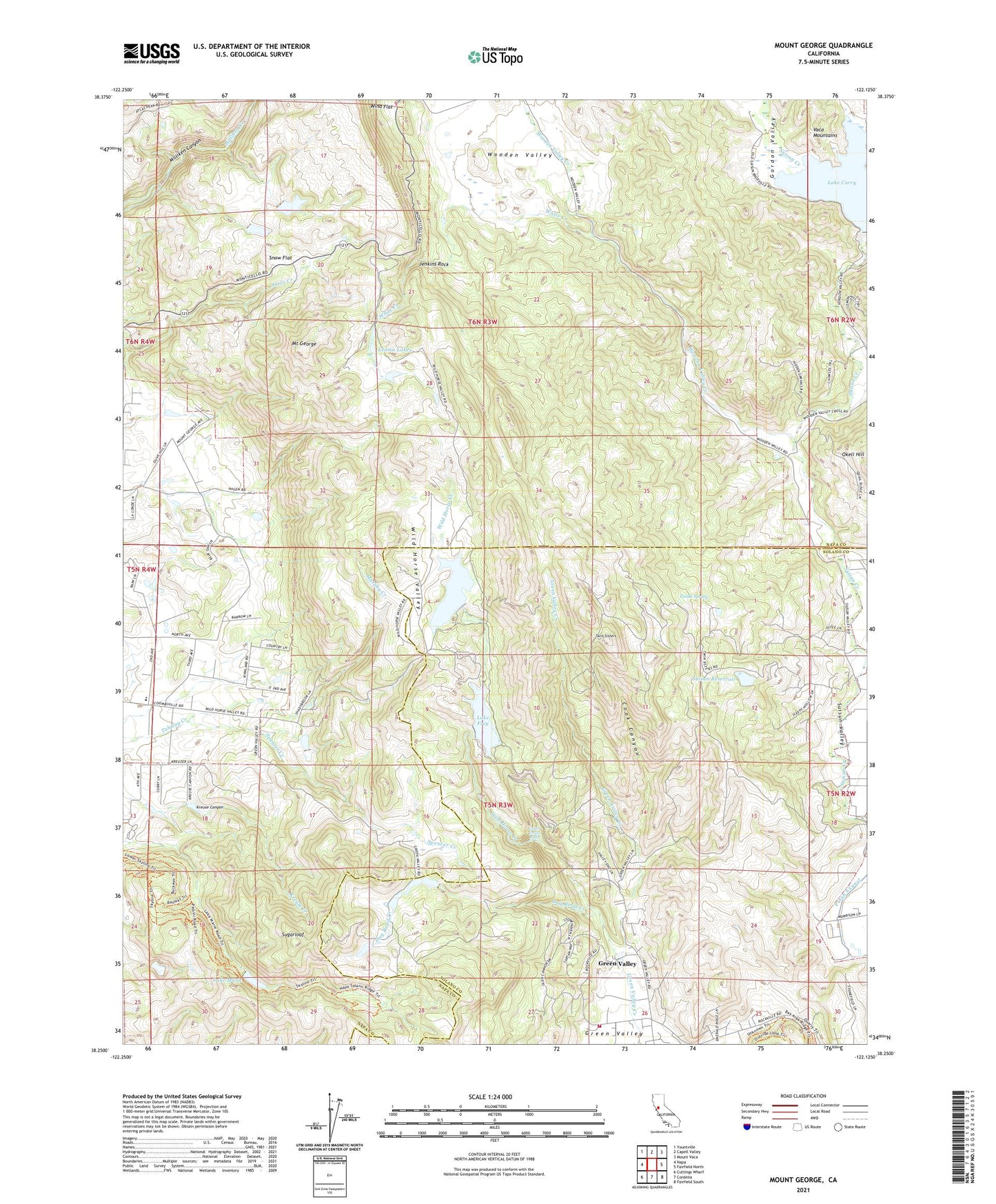
2021 topographic map quadrangle Mount George in the state of California. Scale: 1:24000. Based on the newly updated USGS 7.5' US Topo map series, this map is in the following counties: Napa, Solano. The map contains contour data, water features, and other items you are used to seeing on USGS maps, but also has updated roads and other features. This is the next generation of topographic maps. Printed on high-quality waterproof paper with UV fade-resistant inks.
Quads adjacent to this one:
West: Napa
Northwest: Yountville
North: Capell Valley
Northeast: Mount Vaca
East: Fairfield North
Southeast: Fairfield South
South: Cordelia
Southwest: Cuttings Wharf
Contains the following named places: B J Robinson 2410 Dam, Chimiles Farm Center, Cook Canyon, Cordelia Fire Protection District Station 3, Dug Road Creek, Falls Elementary School, Gordon Valley, Green Valley, Green Valley Census Designated Place, Green Valley Falls, Green Valley Golf Club, Green Valley Lake 447 Dam, Green Valley Picnic Ground, Jenkins Rock, Kreuse Canyon, Lake Curry, Lake Frey, Lake Frey 14-003 Dam, Lake Madigan, Lake Madigan 14-002 Dam, Lake Marie, Lake Marie 1-006 Dam, Leoma Lakes, Mount George, Mount George Elementary School, Municipal 21 Dam, Murphy Creek, Napa Valley Country Club, Snow Flat, Spencer Creek, Sugarloaf, Suisun Reservoir, Thompson 2411 Dam, Timberhill Lake 419 Dam, Tindle Spring, Twin Sisters, Twin Sisters Gun Club, White Creek, Wild Horse Creek, Wild Horse Valley, Wind Flat, Wooden Valley, Wooden Valley Creek