MyTopo
Yountville California US Topo Map
Couldn't load pickup availability
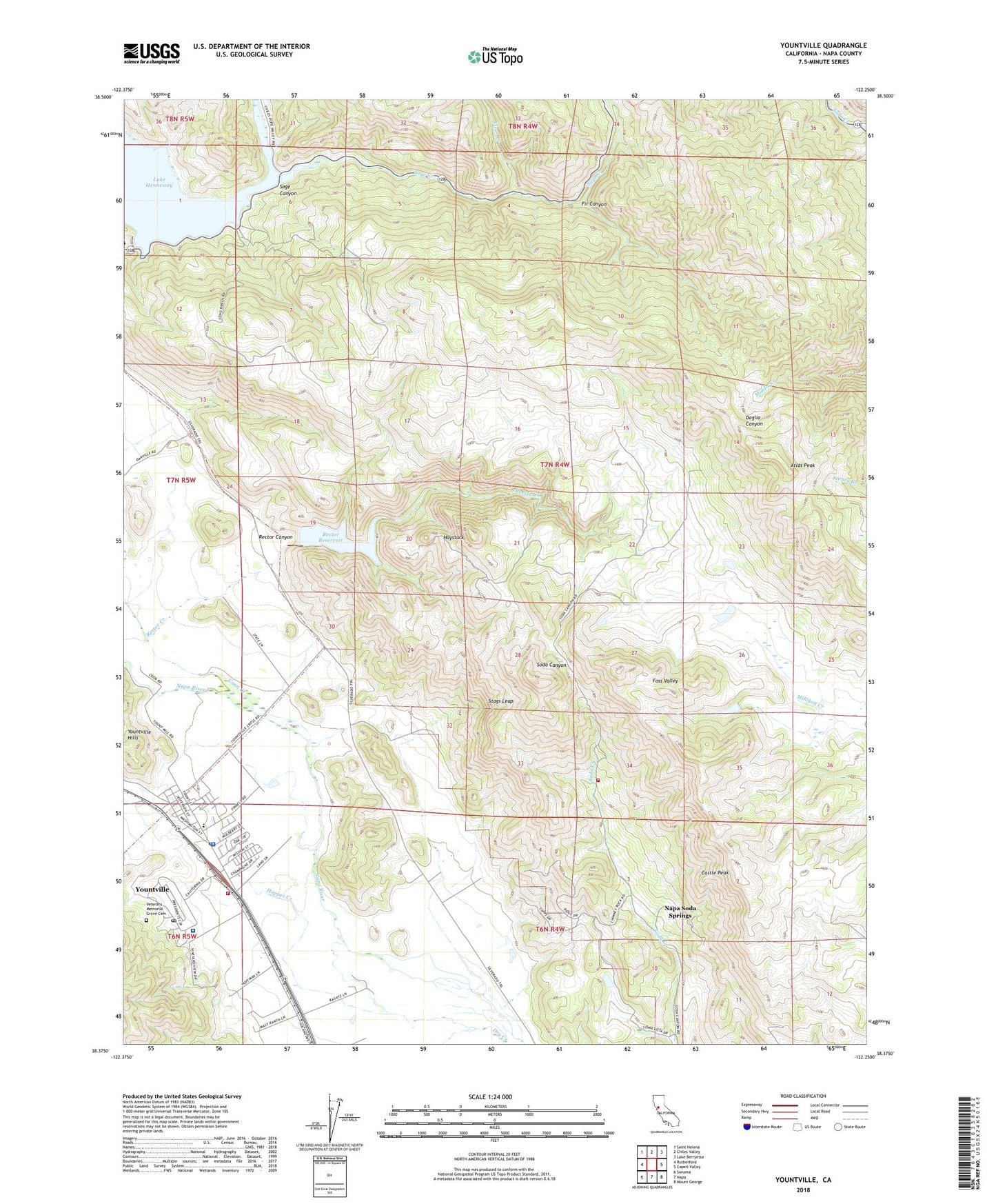
2021 topographic map quadrangle Yountville in the state of California. Scale: 1:24000. Based on the newly updated USGS 7.5' US Topo map series, this map is in the following counties: Napa. The map contains contour data, water features, and other items you are used to seeing on USGS maps, but also has updated roads and other features. This is the next generation of topographic maps. Printed on high-quality waterproof paper with UV fade-resistant inks.
Quads adjacent to this one:
West: Rutherford
Northwest: Saint Helena
North: Chiles Valley
Northeast: Lake Berryessa
East: Capell Valley
Southeast: Mount George
South: Napa
Southwest: Sonoma
This map covers the same area as the classic USGS quad with code o38122d3.
Contains the following named places: Alatera Vineyards, Anderson Vineyards, Atlas Peak, Calafia Winery, Castle Peak, Caymus, Chappellet Vineyards, Chateau Chevre Winery, Chiles Creek, Chimney Rock Golf Course, Circle S 2417 Dam, Circle S Ranch, City of Yountville, Clear Creek, Conn Creek, Conn Dam, Domaine Chandon Winery, Fir Canyon, Girard Winery, Haystack, Hopper Creek, Hopper Creek Winery, KVYN-FM (St. Helena), Lake Hennessey, Lakespring Winery, Napa County Fire Department Station 12 Yountville, Napa County Fire Department Station 13 Soda Canyon, Napa County Sheriff's Office Yountville, Napa Soda Springs, Napa State Farm, Nelson M Holderman Memorial Hospital, Pine Ridge Winery, Pritchard Hill, Rector Canyon, Rector Creek, Rector Creek 1-0 1 Dam, Rector Reservoir, Sage Canyon, Sage Creek, Shafer Vineyards, Silver Oak Cellars, Silverado Vineyard, Stags Leap, Stags Leap Wine Cellars, Veterans Home Post Office, Veterans Memorial Grove Cemetery, Villa Mount Eden Winery, Yountville, Yountville Branch Napa City-County Library, Yountville Community Church, Yountville Elementary School, Yountville Post Office, Yountville Town Hall, ZIP Code: 94599