MyTopo
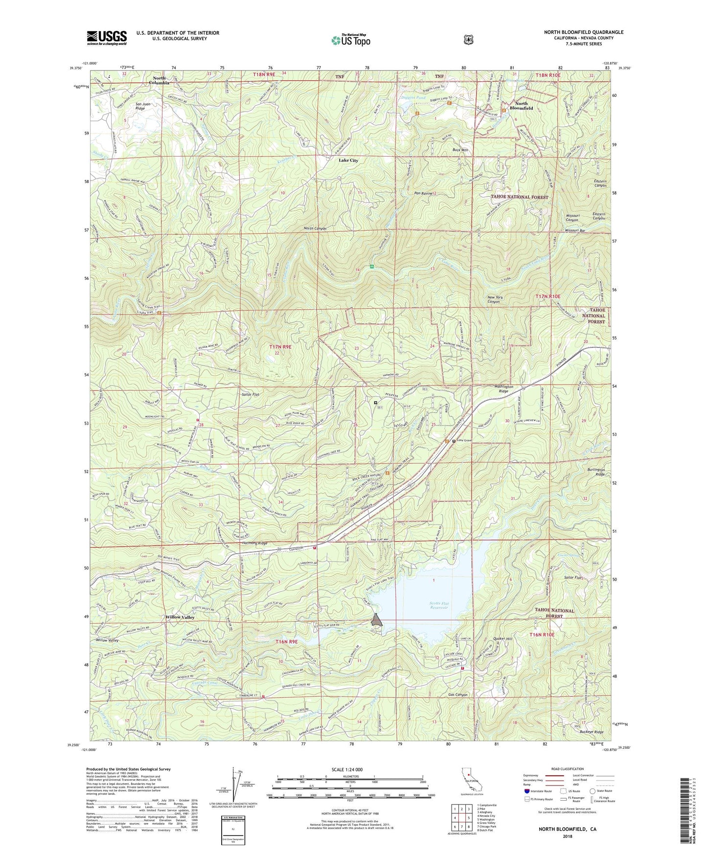
North Bloomfield California US Topo Map
Couldn't load pickup availability
Also explore the North Bloomfield Forest Service Topo of this same quad for updated USFS data
2022 topographic map quadrangle North Bloomfield in the state of California. Scale: 1:24000. Based on the newly updated USGS 7.5' US Topo map series, this map is in the following counties: Nevada. The map contains contour data, water features, and other items you are used to seeing on USGS maps, but also has updated roads and other features. This is the next generation of topographic maps. Printed on high-quality waterproof paper with UV fade-resistant inks.
Quads adjacent to this one:
West: Nevada City
Northwest: Camptonville
North: Pike
Northeast: Alleghany
East: Washington
Southeast: Dutch Flat
South: Chicago Park
Southwest: Grass Valley
This map covers the same area as the classic USGS quad with code o39120c8.
Contains the following named places: Blair Lake, Blue Tent, Blue Tent School, Buck Mountain, Cascade Canal, Cascade Shores, Casci Ranch, Central House, Crystal Hill Mine, Crystal Springs, CYA Camp, Deer Creek Diversion 61-003 Dam, Deer Creek Park, Deer Creek Reservoir, Diggins Loop Trail, Diggins Pond, East Harmony Mine, Eastern Canyon, Edwards Crossing, Federal Loan Mine, Fivemile House, Fountain Head Mine, Fowler Spring, Grizzly Hill Elementary School, Harmony Ridge, Hoge Mine, Humbug Creek, Humbug Trail, Kenebec Creek, Kennebec House, Kirkham Ranch, Lake City, Lone Grave, Malakoff, Malakoff Diggings, Malakoff Diggins State Historic Park, Malakoff Diggins-North Bloomfield Historic District, Malakoff Elementary School, Marten Ranch, Missouri Bar, Missouri Bar Trail, Missouri Canyon, Mosquito Creek, Murchie Mine, Nevada City Division, Nevada County Consolidated Fire District Station 80, Nevada County Consolidated Fire District Station 81, Nevada County Consolidated Fire District Station 82, Nevada County Consolidated Fire District Station 83, New York Canyon, North Bloomfield, North Bloomfield Cemetery, North Bloomfield Forest Service Station, North Canyon, North Columbia, North Fork Deer Creek, Pan Ravine, Quaker Hill, Rock Creek Nature Study Area, Rock Creek Trail Picnic Area, Sailor Flat, Saint Louis Mine, Scott-Flat Campground, Scotts Flat, Scotts Flat 61-018 Dam, Scotts Flat Reservoir, Shonter Hill Campground, Snow Mountain Ditch, South Fork Deer Creek, South Yuba Campground, South Yuba Primitive Campground, South Yuba Trail, Spring Creek, Texas Mine, Tull Ranch, Washington Ridge California Youth Authority Camp, West Harmony Mine, Willow Valley, ZIP Code: 95959