
MyTopo
Orland California US Topo Map
Couldn't load pickup availability
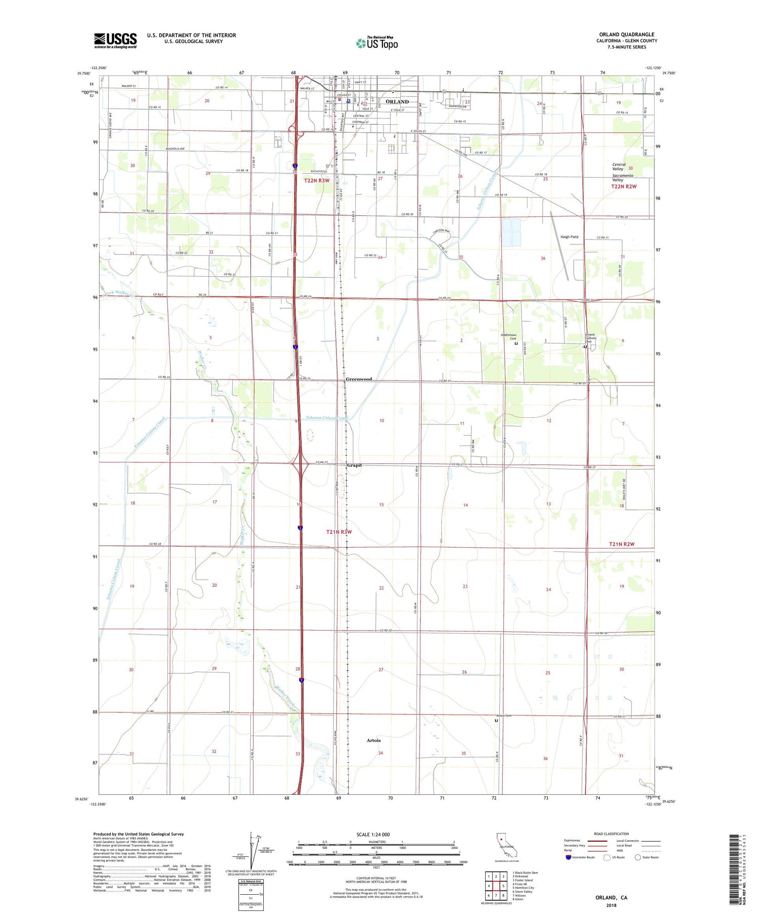
2022 topographic map quadrangle Orland in the state of California. Scale: 1:24000. Based on the newly updated USGS 7.5' US Topo map series, this map is in the following counties: Glenn. The map contains contour data, water features, and other items you are used to seeing on USGS maps, but also has updated roads and other features. This is the next generation of topographic maps. Printed on high-quality waterproof paper with UV fade-resistant inks.
Quads adjacent to this one:
West: Fruto NE
Northwest: Black Butte Dam
North: Kirkwood
Northeast: Foster Island
East: Hamilton City
Southeast: Glenn
South: Willows
Southwest: Stone Valley
This map covers the same area as the classic USGS quad with code o39122f2.
Contains the following named places: Alta Schmidt House Museum, Artois Cemetery, Artois Census Designated Place, Carnegie Community Center, Church of Christ, City of Orland, Evangelical Free Church, Fairview Elementary School, Federated Church, First Apostolic Lighthouse of Jesus Christ Church, First Baptist Church, First Christian Church, Foursquare Christian Fellowship, Glenn County Fairground, Glenn County Sheriff's Office, Grapit, Greenwood, Haigh Field, Lely Aquatic Park, Library Park, Mill Street Elementary School, North Fork Walker Creek, Orland, Orland Catholic Cemetery, Orland City Fire Department / Orland Rural Fire Protection District, Orland City Hall, Orland Free Library, Orland IOOF Cemetery, Orland Police Department, Orland Post Office, Orland Southern Baptist Church, Price Intermediate School, Saint Dominics Roman Catholic Church, South Fork Walker Creek, Westside Ambulance Association


