MyTopo
Pebblestone Shut-in California US Topo Map
Couldn't load pickup availability
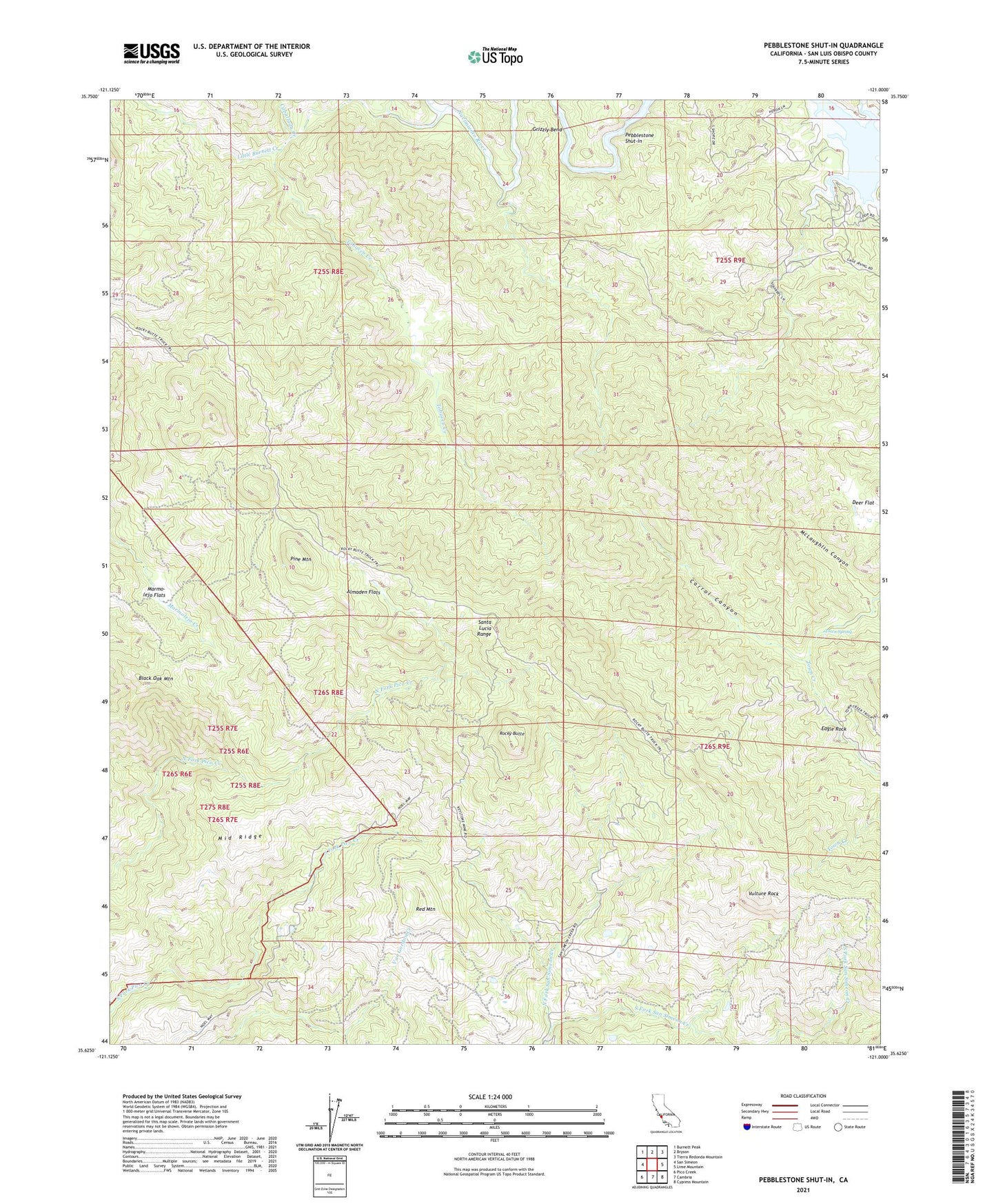
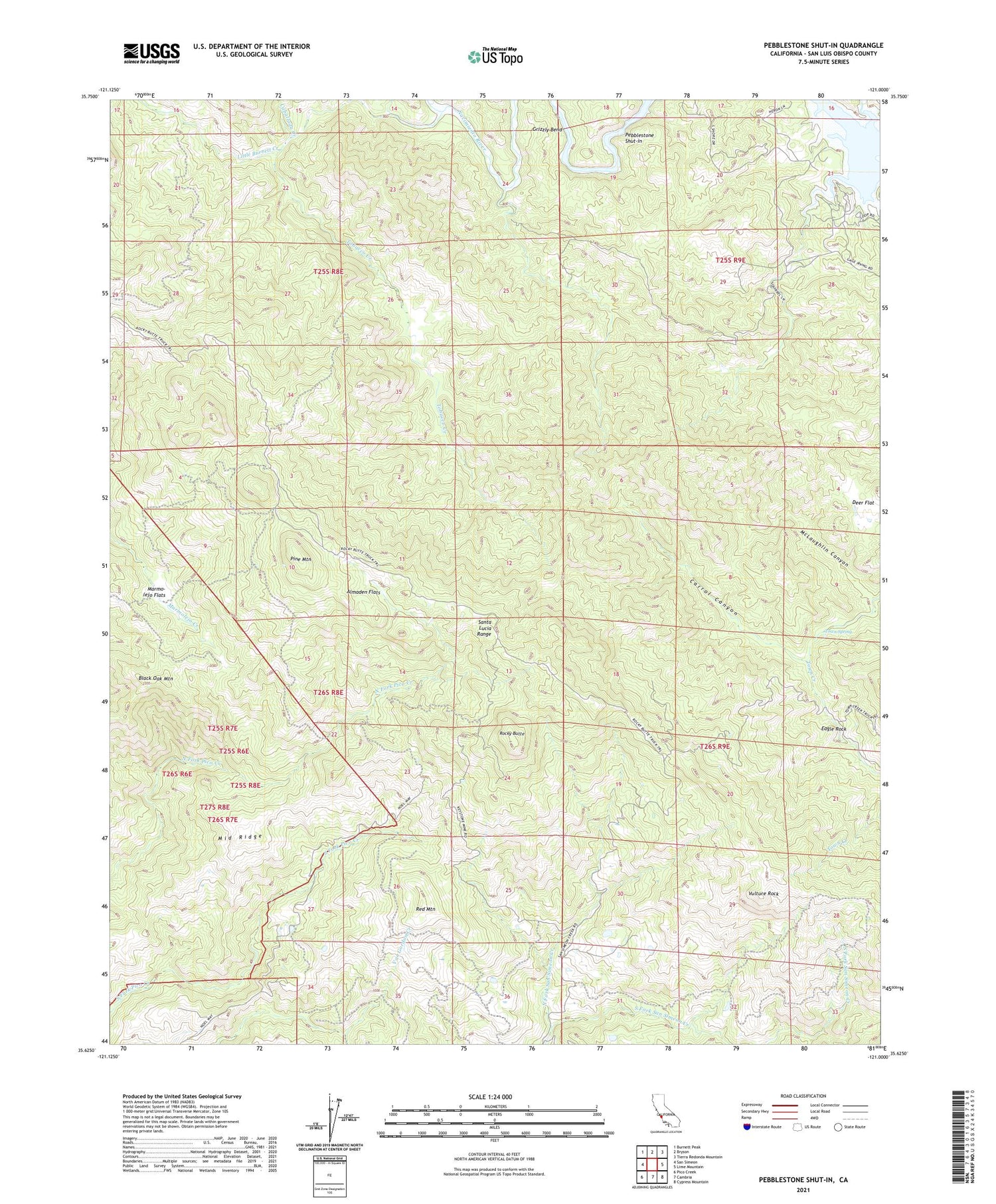
2021 topographic map quadrangle Pebblestone Shut-in in the state of California. Scale: 1:24000. Based on the newly updated USGS 7.5' US Topo map series, this map is in the following counties: San Luis Obispo. The map contains contour data, water features, and other items you are used to seeing on USGS maps, but also has updated roads and other features. This is the next generation of topographic maps. Printed on high-quality waterproof paper with UV fade-resistant inks.
Quads adjacent to this one:
West: San Simeon
Northwest: Burnett Peak
North: Bryson
Northeast: Tierra Redonda Mountain
East: Lime Mountain
Southeast: Cypress Mountain
South: Cambria
Southwest: Pico Creek
This map covers the same area as the classic USGS quad with code o35121f1.
Contains the following named places: Almaden Flats, Almaden Mine, Black Oak Mountain, Buckeye Mine, Caballada Creek, Carrol Canyon, Deer Flat, Eagle Rock, Eucalyptus Lateral Ten, Goat Camp, Gould Creek, Grizzly Bend, Hamilton Mine, Kavanaugh Creek, Keystone Mine, Little Burnett Creek, Marmo-lejo Flats, McLaughlin Canyon, Middle Ridge, North Fork San Simeon Creek, North Grizzly Bend Creek, Ocean View Mine, Pebblestone Shut-in, Pine Mountain, Pine Mountain Mine, Quien Sabe Mine, Red Mountain, Rocky Butte, Rocky Butte Lookout, Tobacco Creek, Town Spring, Vulture Rock