MyTopo
Tierra Redonda Mountain California US Topo Map
Couldn't load pickup availability
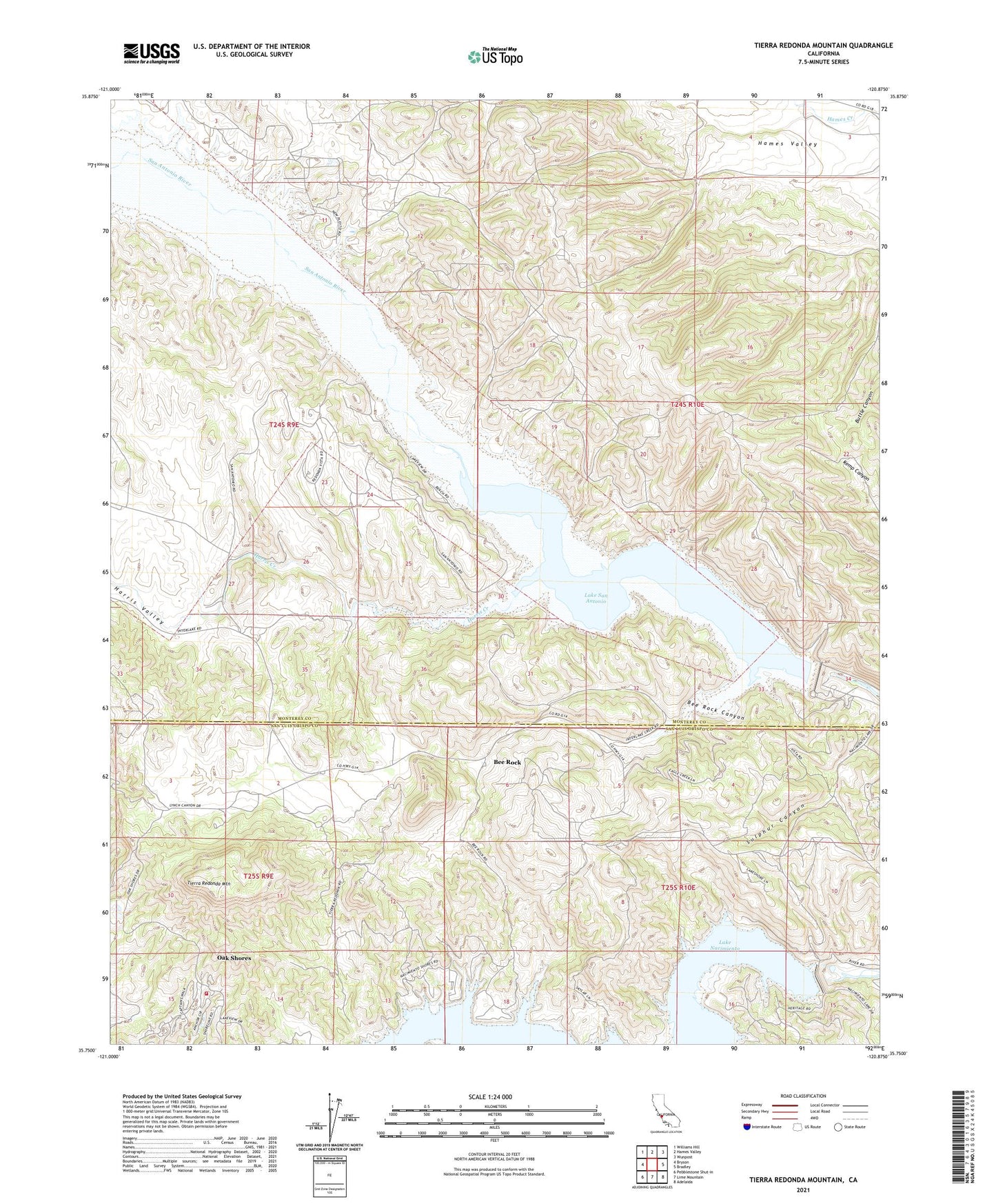
2021 topographic map quadrangle Tierra Redonda Mountain in the state of California. Scale: 1:24000. Based on the newly updated USGS 7.5' US Topo map series, this map is in the following counties: Monterey, San Luis Obispo. The map contains contour data, water features, and other items you are used to seeing on USGS maps, but also has updated roads and other features. This is the next generation of topographic maps. Printed on high-quality waterproof paper with UV fade-resistant inks.
Quads adjacent to this one:
West: Bryson
Northwest: Williams Hill
North: Hames Valley
Northeast: Wunpost
East: Bradley
Southeast: Adelaida
South: Lime Mountain
Southwest: Pebblestone Shut-in
Contains the following named places: Bee Rock, Bee Rock Canyon, Bee Rock Hall, Bee Rock School, Branch Ranch, California Department of Forestry and Fire Protection Station 34 Oak Shores, Godfrey Ranch, Hames School, Harris Creek, Harris Valley, Lake San Antonio, Lynch Ranch, Nacimiento Dam, Nacimiento Lake Marina, Oak Shores Census Designated Place, Pleyto, San Antonio 1008-002 Dam, San Antonio Dam, Tierra Redonda Mountain, Williams Ranch, ZIP Code: 93426