MyTopo
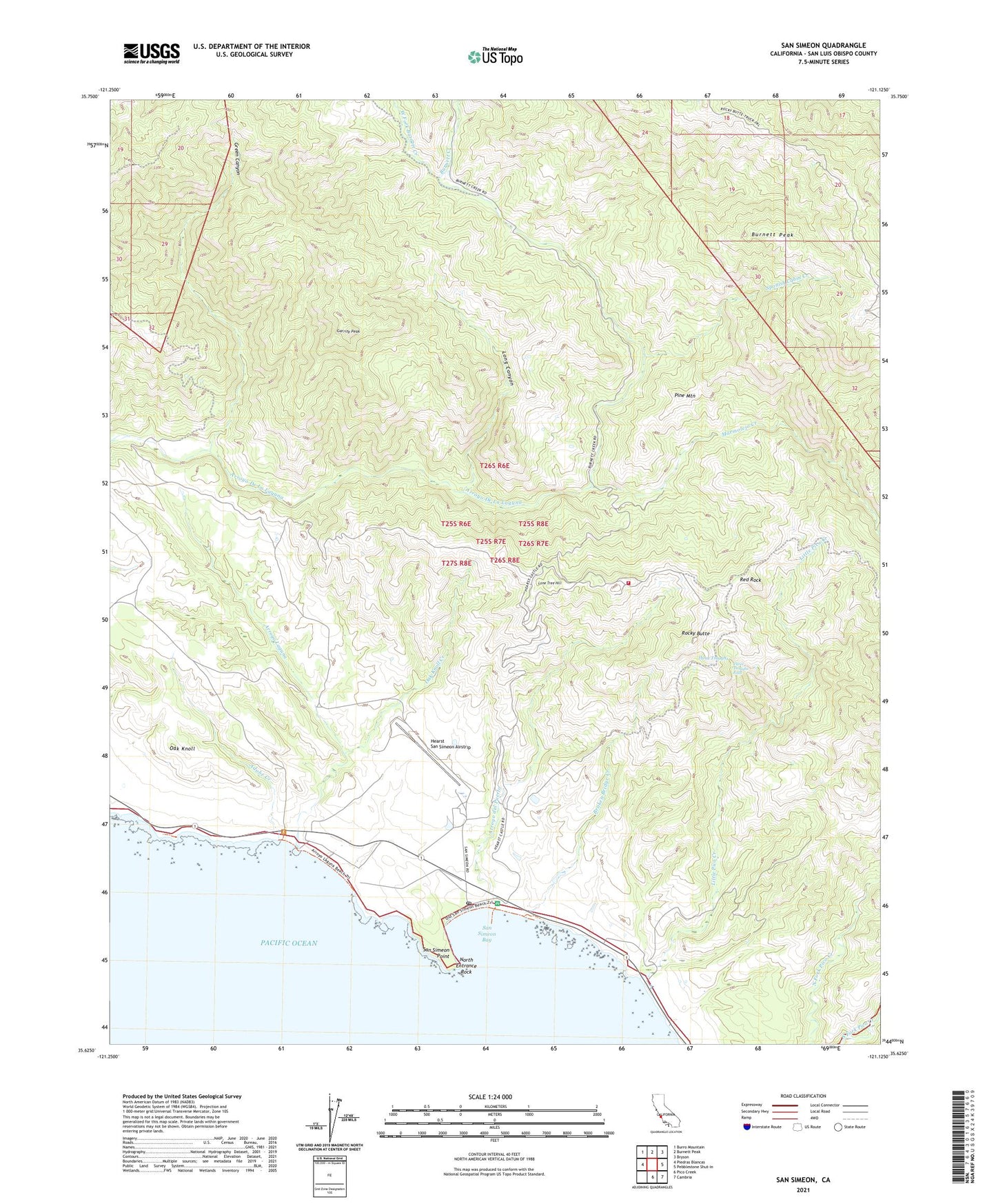
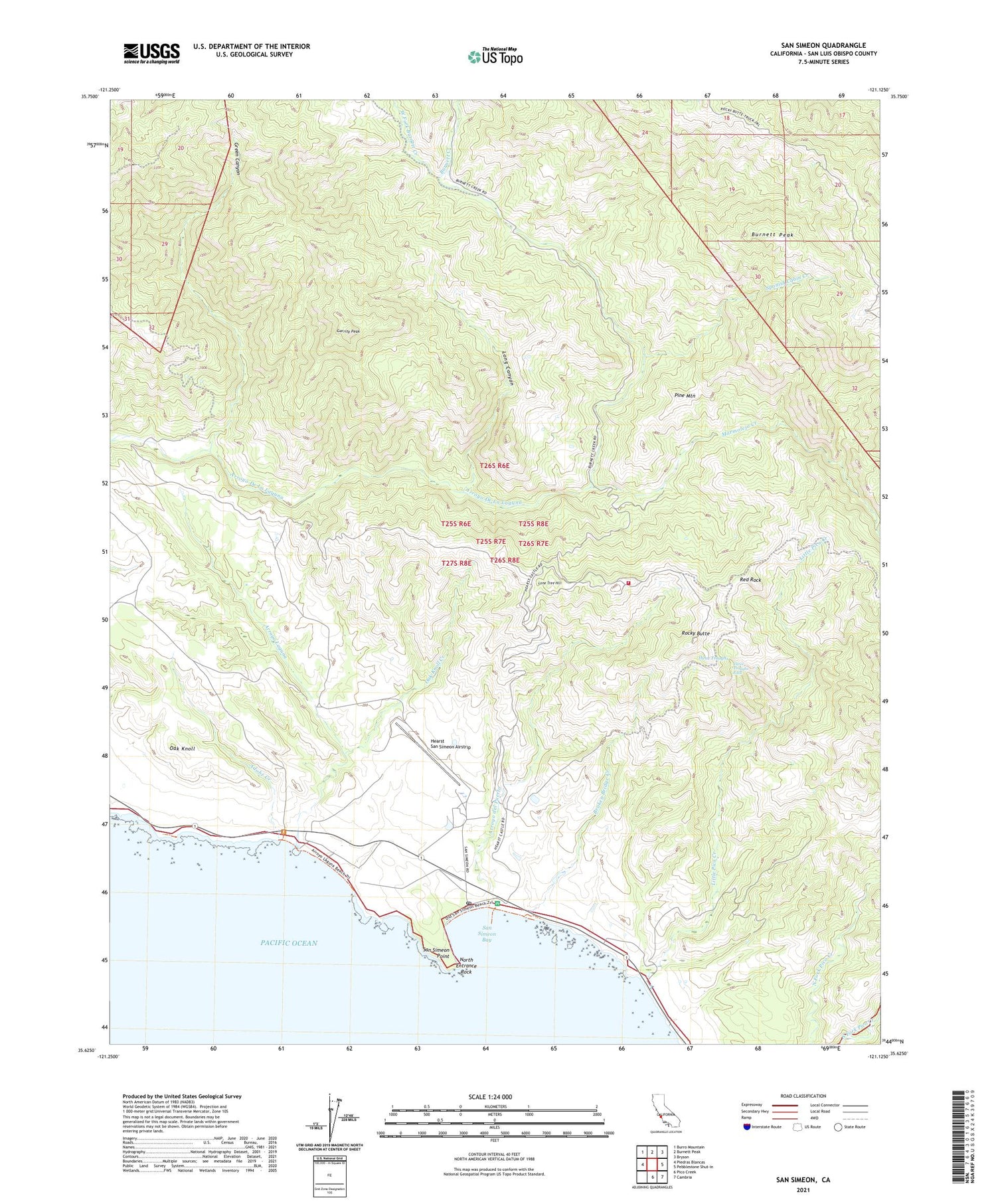
San Simeon California US Topo Map
Couldn't load pickup availability
2021 topographic map quadrangle San Simeon in the state of California. Scale: 1:24000. Based on the newly updated USGS 7.5' US Topo map series, this map is in the following counties: San Luis Obispo. The map contains contour data, water features, and other items you are used to seeing on USGS maps, but also has updated roads and other features. This is the next generation of topographic maps. Printed on high-quality waterproof paper with UV fade-resistant inks.
Quads adjacent to this one:
West: Piedras Blancas
Northwest: Burro Mountain
North: Burnett Peak
Northeast: Bryson
East: Pebblestone Shut-in
Southeast: Cambria
South: Pico Creek
This map covers the same area as the classic USGS quad with code o35121f2.
Contains the following named places: Adobe Creek, Arroyo del Puerto, Arroyo Laguna, Broken Bridge Creek, Burnett Camp, Burnett Creek, Burnett Peak, Chileno Camp, Garrity Peak, Green Canyon, Hearst Airport, Hearst Castle, Hearst Castle Fire Department, Hearst Park, Hearst Ranch, Hearst San Simeon State Historical Monument, Little Pico Creek, Lone Tree Hill, Long Canyon, Marmolejo Creek, North Entrance Rock, Oak Knoll, Oak Knoll Creek, Old Castro House, Piedra Blanca, Pine Mountain, Red Rock, Rocky Butte, San Simeon, San Simeon Bay, San Simeon Point, San Simeon Post Office, Spanish Cabin Creek, Three Troughs, Three Troughs Falls, Tortuga Creek, West Fork Burnett Creek, William Randolph Hearst Memorial Beach, ZIP Code: 93452