MyTopo
Picacho NW California US Topo Map
Couldn't load pickup availability
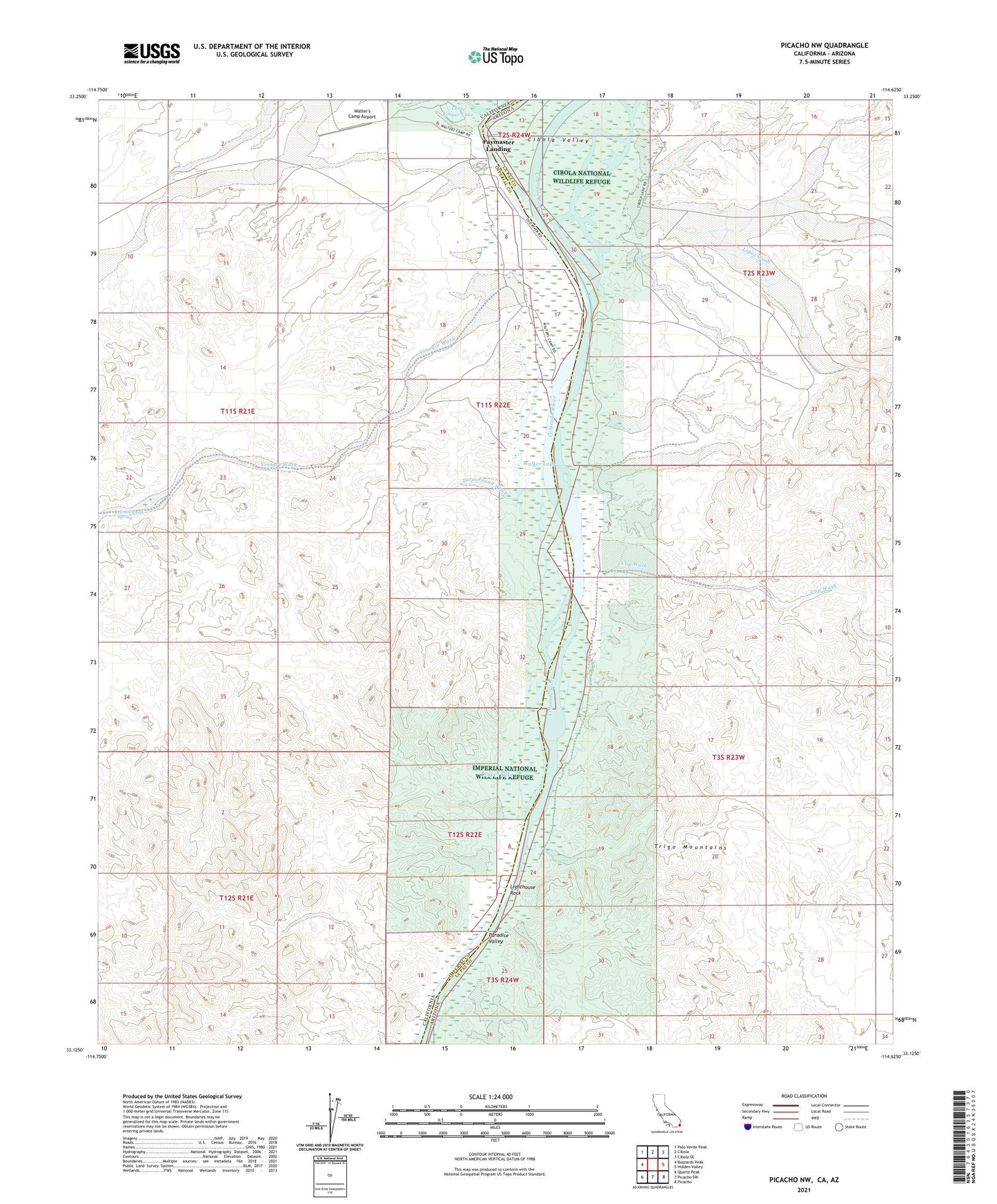
2021 topographic map quadrangle Picacho NW in the states of California, Arizona. Scale: 1:24000. Based on the newly updated USGS 7.5' US Topo map series, this map is in the following counties: Imperial, La Paz. The map contains contour data, water features, and other items you are used to seeing on USGS maps, but also has updated roads and other features. This is the next generation of topographic maps. Printed on high-quality waterproof paper with UV fade-resistant inks.
Quads adjacent to this one:
West: Buzzards Peak
Northwest: Palo Verde Peak
North: Cibola
Northeast: Cibola SE
East: Hidden Valley
Southeast: Picacho
South: Picacho SW
Southwest: Quartz Peak
This map covers the same area as the classic USGS quad with code o33114b6.
Contains the following named places: Arrowweed Spring, Cibola Camp, Cibola Lake, Cibola Valley, Clip Mill, Clip Wash, Draper Lake, Draper Ranch, Draper Wash, Gilmores Camp, Lighthouse Rock, Lopez Wash, Paymaster Landing, Perphery Gate, Turnaround Wash, Vinagre Wash, Walker Lake, Walters Camp, Walter's Camp Airport