MyTopo
Pigeon Point California US Topo Map
Couldn't load pickup availability
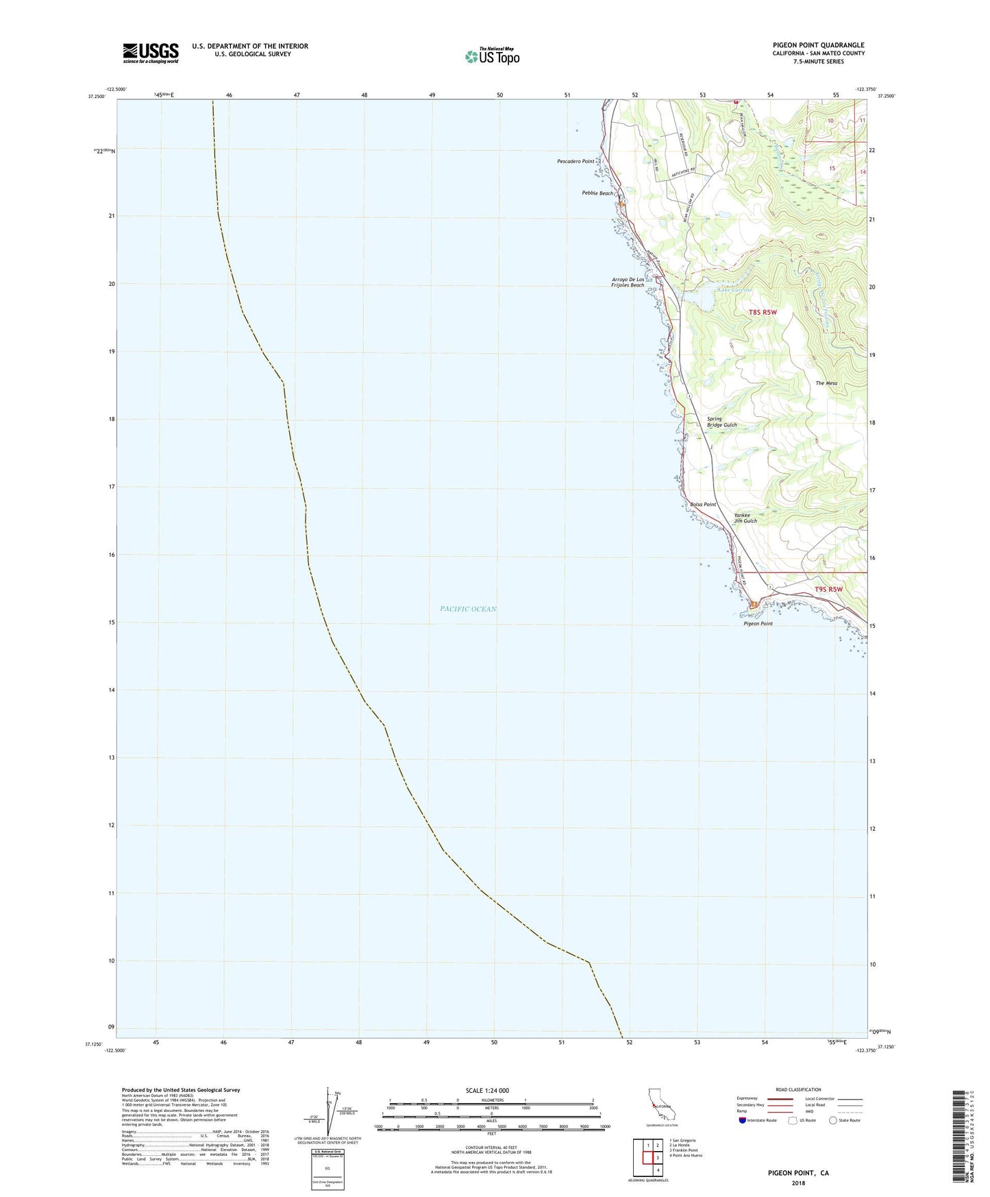
2021 topographic map quadrangle Pigeon Point in the state of California. Scale: 1:24000. Based on the newly updated USGS 7.5' US Topo map series, this map is in the following counties: San Mateo. The map contains contour data, water features, and other items you are used to seeing on USGS maps, but also has updated roads and other features. This is the next generation of topographic maps. Printed on high-quality waterproof paper with UV fade-resistant inks.
Quads adjacent to this one:
North: San Gregorio
Northeast: La Honda
East: Franklin Point
Southeast: Point Ano Nuevo
This map covers the same area as the classic USGS quad with code o37122b4.
Contains the following named places: Arroyo De Los Frijoles, Arroyo De Los Frijoles Beach, Bean Hollow State Beach, Bolsa Point, CAL FIRE San Mateo County Fire Department Pescadero Station 59, Lake Lucerne, Lake Lucerne 602 Dam, Pebble Beach, Pescadero High Power Homing Station, Pescadero Point, Pigeon Point, Pigeon Point Light Station, Pigeon Point Light Station State Historic Park, Spring Bridge Gulch, The Mesa, Yankee Jim Gulch