MyTopo
San Gregorio California US Topo Map
Couldn't load pickup availability
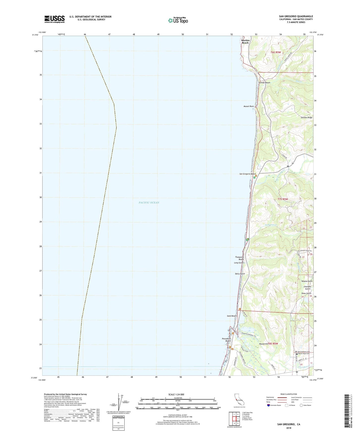
2022 topographic map quadrangle San Gregorio in the state of California. Scale: 1:24000. Based on the newly updated USGS 7.5' US Topo map series, this map is in the following counties: San Mateo. The map contains contour data, water features, and other items you are used to seeing on USGS maps, but also has updated roads and other features. This is the next generation of topographic maps. Printed on high-quality waterproof paper with UV fade-resistant inks.
Quads adjacent to this one:
North: Half Moon Bay
Northeast: Woodside
East: La Honda
Southeast: Franklin Point
South: Pigeon Point
This map covers the same area as the classic USGS quad with code o37122c4.
Contains the following named places: Bradley Creek, Butano Creek, Chandler Gulch, Dairy Gulch, Dry Creek, First Congregational Church of Pescadero, Gordons Landing, Half Moon Bay Division, Long Gulch, Martins Beach, Mount Hope Cemetery, Mussel Rock, Pescadero, Pescadero Beach, Pescadero Creek, Pescadero Elementary School, Pescadero Marsh Natural Preserve, Pescadero Post Office, Pescadero State Beach, Pomponio Beach, Pomponio Creek, Pomponio State Beach, Round Hill, Saint Anthony Cemetery, San Antonio or Pescadero, San Gregorio, San Gregorio Beach, San Gregorio Creek, San Gregorio Post Office, San Gregorio State Beach, San Mateo Coast State Beaches, Sand Beach, Shaw Gulch, Tahana Gulch, Tunitas Beach, Tunitas Creek