MyTopo
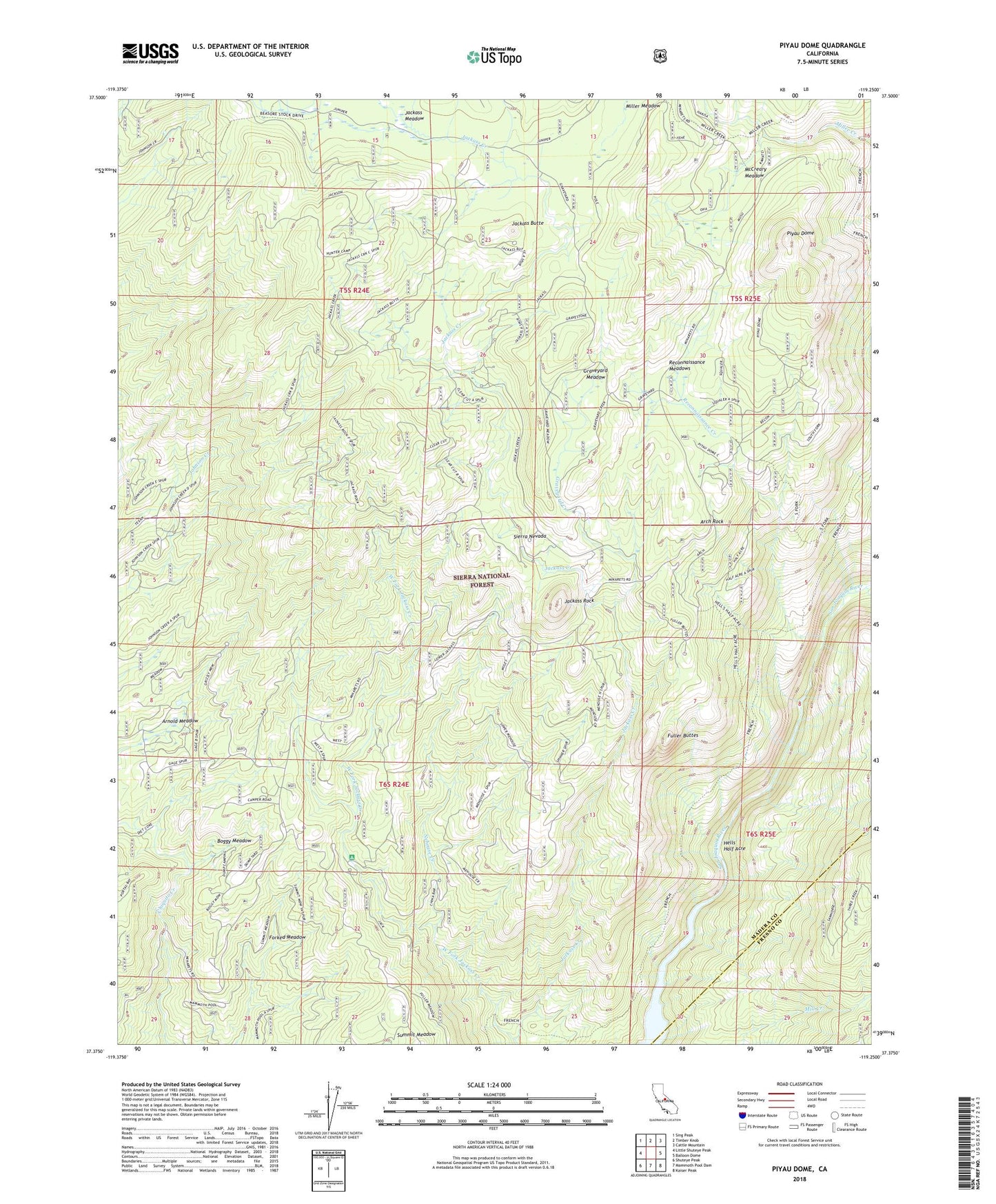
Piyau Dome California US Topo Map
Couldn't load pickup availability
Also explore the Piyau Dome Forest Service Topo of this same quad for updated USFS data
2021 topographic map quadrangle Piyau Dome in the state of California. Scale: 1:24000. Based on the newly updated USGS 7.5' US Topo map series, this map is in the following counties: Madera, Fresno. The map contains contour data, water features, and other items you are used to seeing on USGS maps, but also has updated roads and other features. This is the next generation of topographic maps. Printed on high-quality waterproof paper with UV fade-resistant inks.
Quads adjacent to this one:
West: Little Shuteye Peak
Northwest: Sing Peak
North: Timber Knob
Northeast: Cattle Mountain
East: Balloon Dome
Southeast: Kaiser Peak
South: Mammoth Pool Dam
Southwest: Shuteye Peak
Contains the following named places: Arch Rock, Arnold Meadow, Boggy Meadow, Forked Meadow, French Trail, Fuller Buttes, Graveyard Creek, Graveyard Meadow, Hells Half Acre, Hells Half Acre Trail, Jackass Butte, Jackass Meadow, Jackass Rock, Jackass Rock Organization Camp, Jones Cow Camp, Little Jackass Campground, McCreary Meadow, McCreary Meadow Campground, McDougald Cow Camp, Minarets Forest Service Station, Minarets Work Center, Nehouse Creek, Norris Creek, Piyau Dome, Reconnaissance Creek, Reconnaissance Meadows, South Fork Trail, Summit Meadow, West Fork Jackass Creek