MyTopo
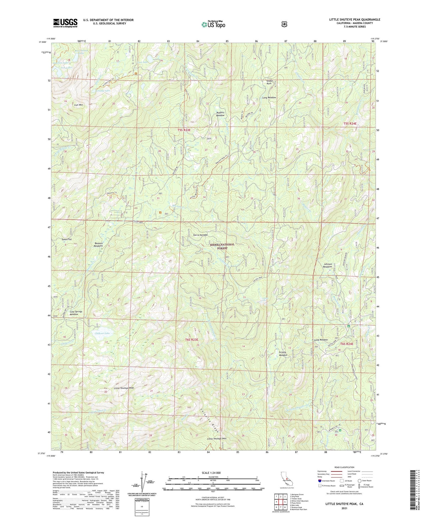
Little Shuteye Peak California US Topo Map
Couldn't load pickup availability
Also explore the Little Shuteye Peak Forest Service Topo of this same quad for updated USFS data
2021 topographic map quadrangle Little Shuteye Peak in the state of California. Scale: 1:24000. Based on the newly updated USGS 7.5' US Topo map series, this map is in the following counties: Madera. The map contains contour data, water features, and other items you are used to seeing on USGS maps, but also has updated roads and other features. This is the next generation of topographic maps. Printed on high-quality waterproof paper with UV fade-resistant inks.
Quads adjacent to this one:
West: White Chief Mountain
Northwest: Mariposa Grove
North: Sing Peak
Northeast: Timber Knob
East: Piyau Dome
Southeast: Mammoth Pool Dam
South: Shuteye Peak
Southwest: Bass Lake
This map covers the same area as the classic USGS quad with code o37119d4.
Contains the following named places: Bare Island Lake, Beasore Creek, Beasore Meadows, Beasore Meadows Campground, Beasore Subdivision, Blackmans Bar, Buchenau Cabin, Camino Campground, Camino Creek, Camino Falls, Chilkoot Lake, Cold Springs Meadow, Future Farmers of America Camp, Globe Rock, Grizzly Lake, Grizzly Meadow, Iron Lakes, Iron Mountain, Johnson Creek, Johnson Meadows, Jones Store, Junction Lake, Kates Cow Camp, Little Shuteye Pass, Little Shuteye Peak, Long Meadow, Lost Lake, Lost Lake Creek, Lower Chiquito Campground, McSwain Mine, Mugler Creek, Muglers Meadow, North McSwain Mine, Oakhurst-North Fork Division, Portuguese Creek, Ryans Cow Camp, Ryans Upper Cow Camp, Shuteye Creek, Soda Springs Campground, Strasbaugh Mine, Swortzets Camp, Tex Flat, Texas Flat, Topping Cow Camp