MyTopo
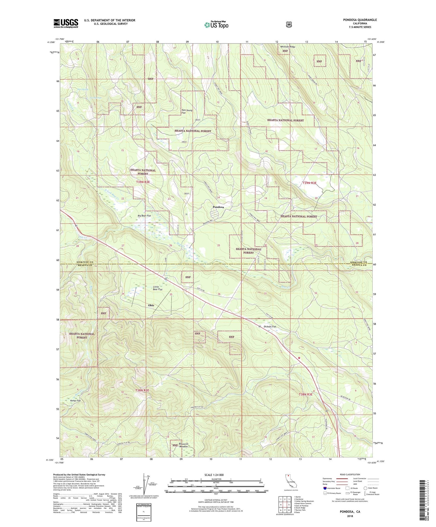
Pondosa California US Topo Map
Couldn't load pickup availability
Also explore the Pondosa Forest Service Topo of this same quad for updated USFS data
2022 topographic map quadrangle Pondosa in the state of California. Scale: 1:24000. Based on the newly updated USGS 7.5' US Topo map series, this map is in the following counties: Siskiyou, Shasta. The map contains contour data, water features, and other items you are used to seeing on USGS maps, but also has updated roads and other features. This is the next generation of topographic maps. Printed on high-quality waterproof paper with UV fade-resistant inks.
Quads adjacent to this one:
West: Dead Horse Summit
Northwest: Bartle
North: Hambone
Northeast: Indian Spring Mountain
East: East of Pondosa
Southeast: Dana
South: Burney Falls
Southwest: Skunk Ridge
This map covers the same area as the classic USGS quad with code o41121b6.
Contains the following named places: Baker Place, Big Bear Flat, Bosworth Meadow, California Department of Forestry and Fire Protection Pondosa, Deer Spring, Dickson Flat, Florin Crossing, Harlow Place, Kemp Flat, Little Bear Flat, Long Ranch, North Fork Bear Creek, North Fork Creek, Obie, Pole Creek, Pondosa, Pondosa Dam, Pondosa Fire Control Station, Tom Young Flat, Two Springs