MyTopo
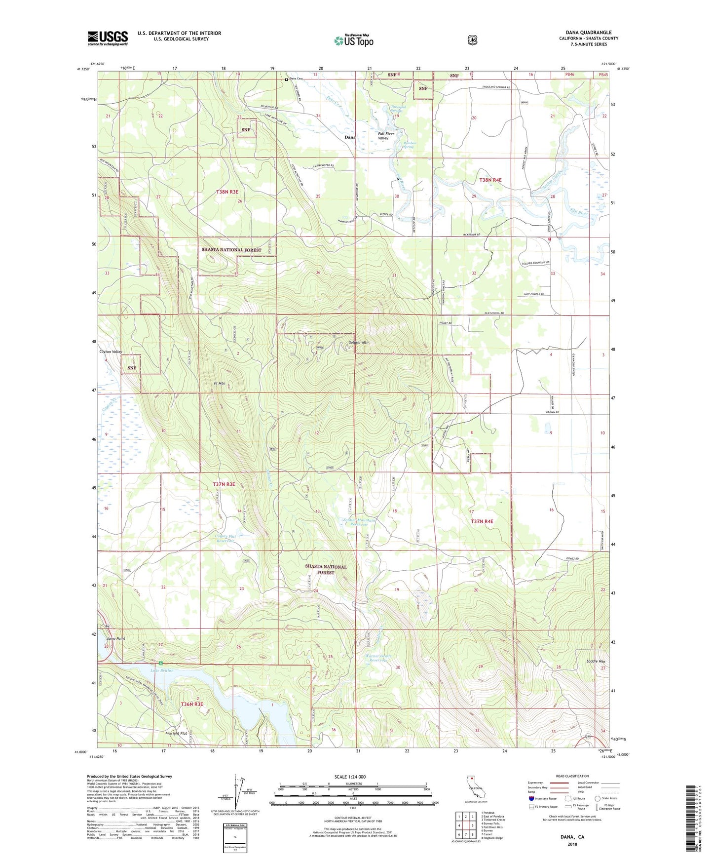
Dana California US Topo Map
Couldn't load pickup availability
Also explore the Dana Forest Service Topo of this same quad for updated USFS data
2022 topographic map quadrangle Dana in the state of California. Scale: 1:24000. Based on the newly updated USGS 7.5' US Topo map series, this map is in the following counties: Shasta. The map contains contour data, water features, and other items you are used to seeing on USGS maps, but also has updated roads and other features. This is the next generation of topographic maps. Printed on high-quality waterproof paper with UV fade-resistant inks.
Quads adjacent to this one:
West: Burney Falls
Northwest: Pondosa
North: East of Pondosa
Northeast: Timbered Crater
East: Fall River Mills
Southeast: Hogback Ridge
South: Cassel
Southwest: Burney
This map covers the same area as the classic USGS quad with code o41121a5.
Contains the following named places: Bear Creek, Burney Pit, Coyote Flat Reservoir, Dana, Dana Cemetery, Dusty Campground, Fort Mountain, Gomez, Horrs Four Corners, Jamo Point, Rainbow Spring, Ricks Fishing Lodge, Soldier Mountain, Soldier Mountain Reservoir, Soldier Mountain Volunteer Fire Company Station 13, Spring Creek, Thousand Springs, Warner Grade Reservoir