MyTopo
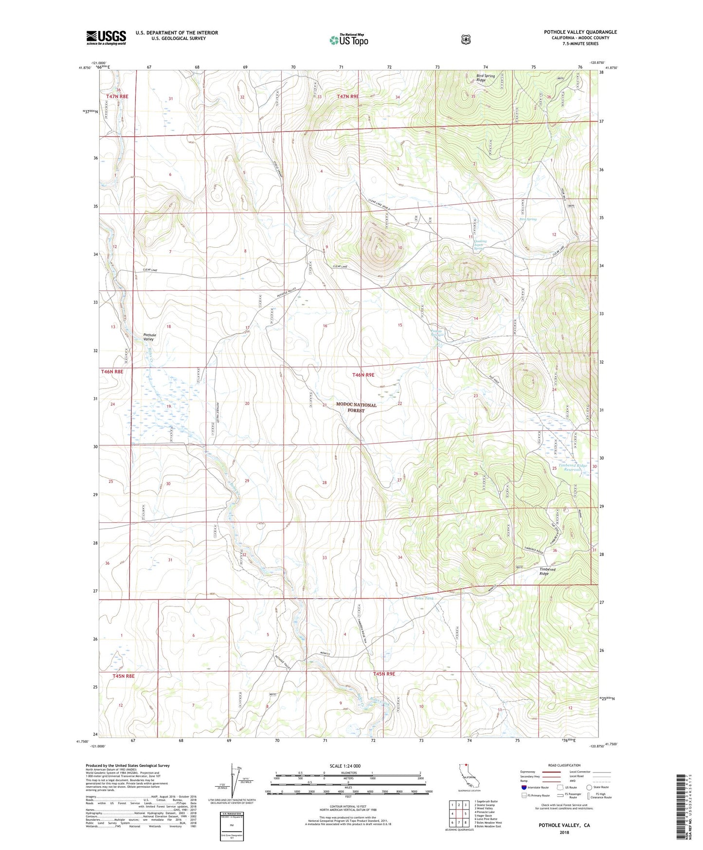
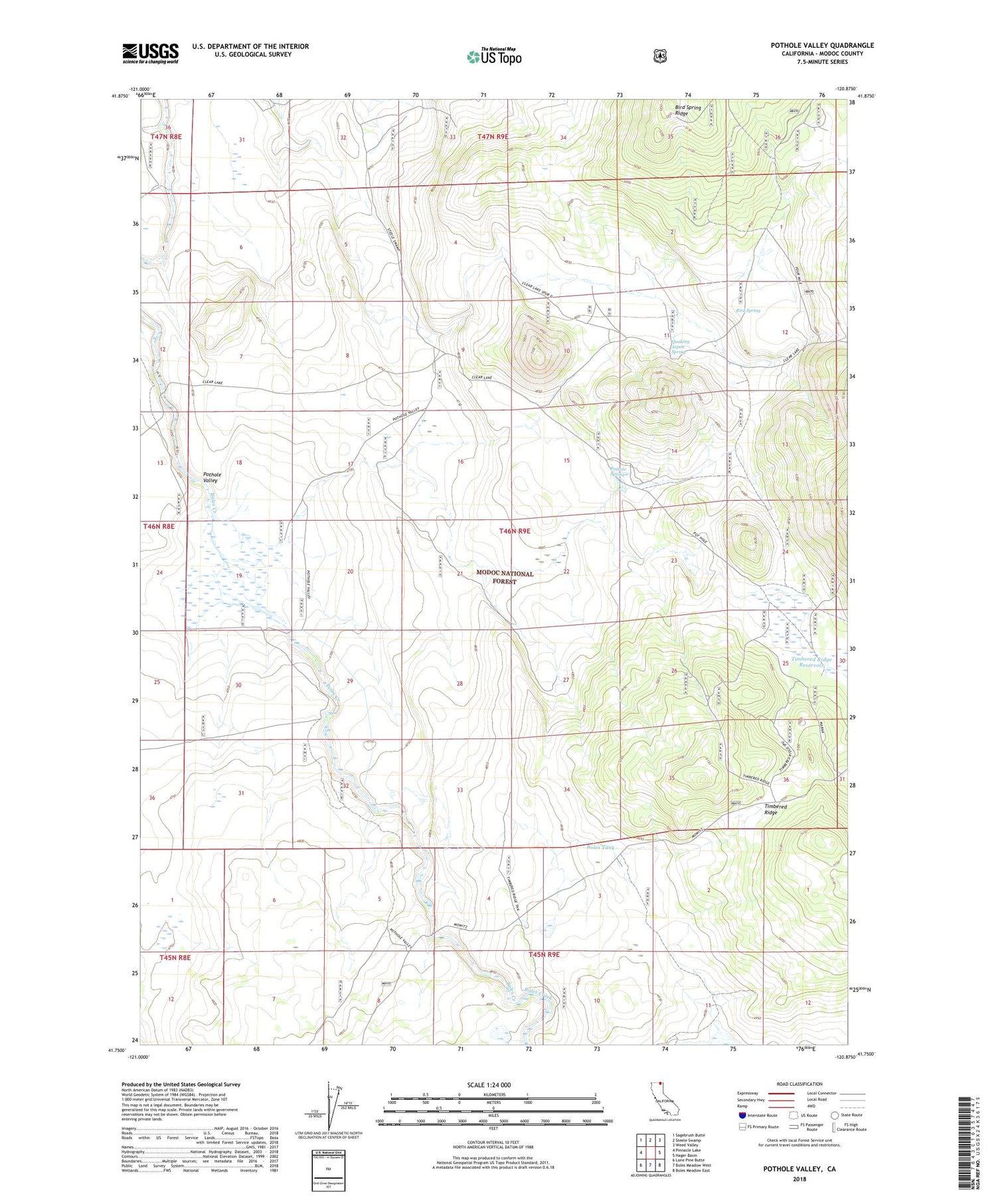
Pothole Valley California US Topo Map
Couldn't load pickup availability
Also explore the Pothole Valley Forest Service Topo of this same quad for updated USFS data
2021 topographic map quadrangle Pothole Valley in the state of California. Scale: 1:24000. Based on the newly updated USGS 7.5' US Topo map series, this map is in the following counties: Modoc. The map contains contour data, water features, and other items you are used to seeing on USGS maps, but also has updated roads and other features. This is the next generation of topographic maps. Printed on high-quality waterproof paper with UV fade-resistant inks.
Quads adjacent to this one:
West: Pinnacle Lake
Northwest: Sagebrush Butte
North: Steele Swamp
Northeast: Weed Valley
East: Hager Basin
Southeast: Boles Meadow East
South: Boles Meadow West
Southwest: Lone Pine Butte
This map covers the same area as the classic USGS quad with code o41120g8.
Contains the following named places: Bird Spring, Bird Spring Ridge, Boles Tank, Pothole Spring, Pothole Valley, Quaking Aspen Spring, Timbered Ridge, Timbered Ridge Reservoir