MyTopo
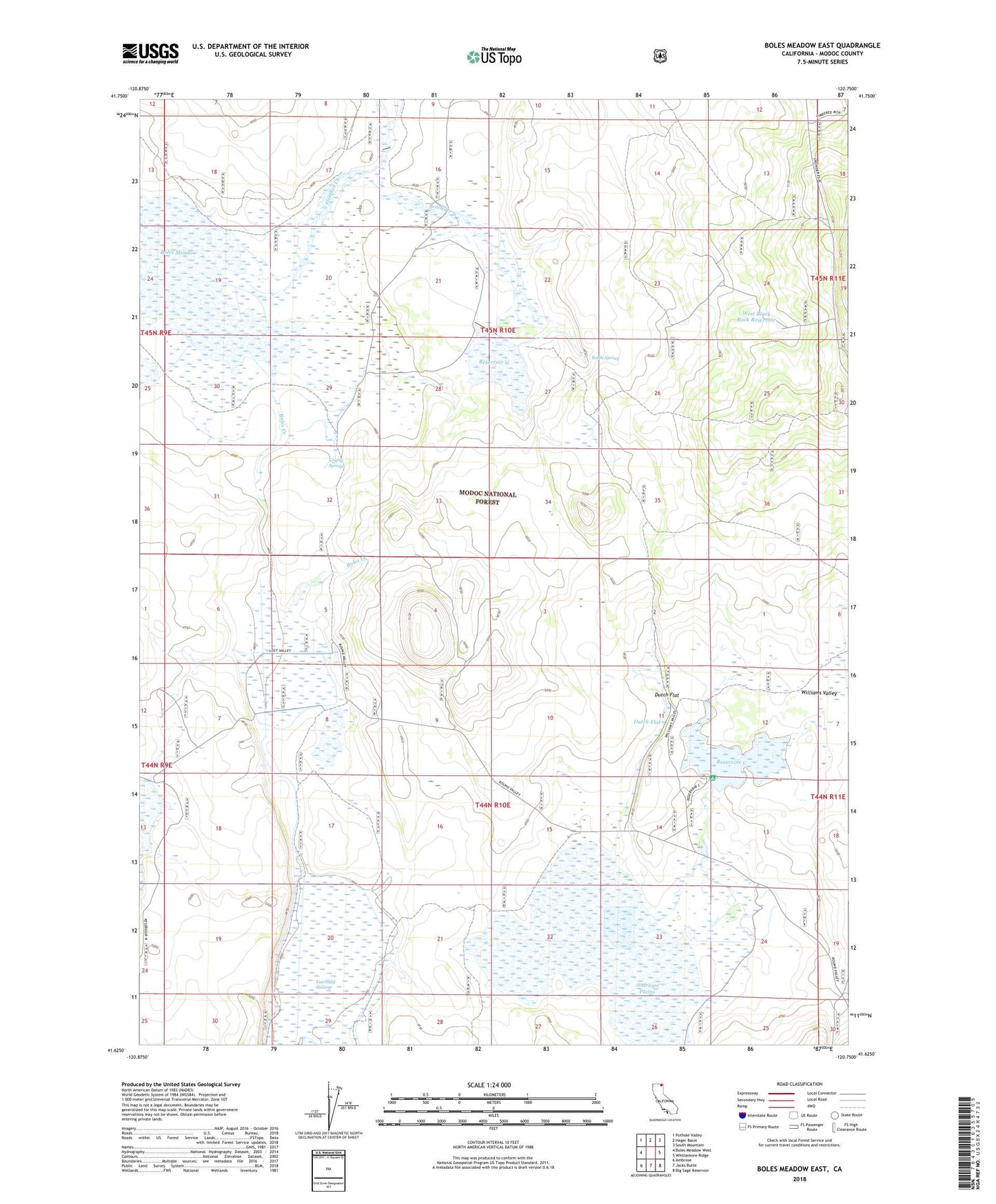
Boles Meadow East California US Topo Map
Couldn't load pickup availability
Also explore the Boles Meadow East Forest Service Topo of this same quad for updated USFS data
2021 topographic map quadrangle Boles Meadow East in the state of California. Scale: 1:24000. Based on the newly updated USGS 7.5' US Topo map series, this map is in the following counties: Modoc. The map contains contour data, water features, and other items you are used to seeing on USGS maps, but also has updated roads and other features. This is the next generation of topographic maps. Printed on high-quality waterproof paper with UV fade-resistant inks.
Quads adjacent to this one:
West: Boles Meadow West
Northwest: Pothole Valley
North: Hager Basin
Northeast: South Mountain
East: Whittemore Ridge
Southeast: Big Sage Reservoir
South: Jacks Butte
Southwest: Ambrose
Contains the following named places: Antelope Plains, Bottle Creek, Bottle Spring, Coyote Springs, Dutch Flat, Fletcher Creek, Reservoir C, Reservoir C Campground, Reservoir G, Round Valley, Round Valley Ranch, Triangle Headquarters, Ulbright, West Black Rock Reservoir