MyTopo
Weed Valley California US Topo Map
Couldn't load pickup availability
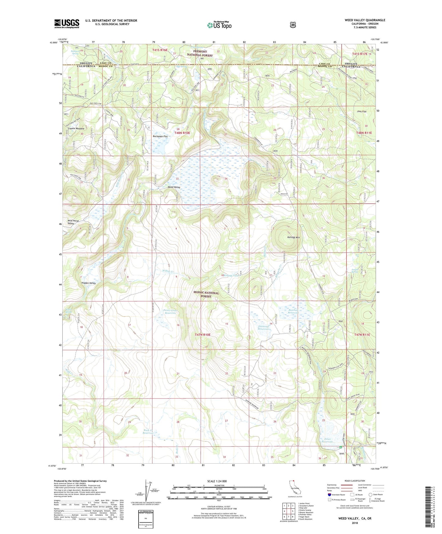
2021 topographic map quadrangle Weed Valley in the states of California, Oregon. Scale: 1:24000. Based on the newly updated USGS 7.5' US Topo map series, this map is in the following counties: Modoc, Lake. The map contains contour data, water features, and other items you are used to seeing on USGS maps, but also has updated roads and other features. This is the next generation of topographic maps. Printed on high-quality waterproof paper with UV fade-resistant inks.
Quads adjacent to this one:
West: Steele Swamp
Northwest: Antler Point
North: Strawberry Butte
Northeast: Dog Lake
East: Beaver Mountain
Southeast: South Mountain
South: Hager Basin
Southwest: Pothole Valley
Contains the following named places: Baseball Reservoir, Buchanan Flat, Buckhorn Spring, Coyote Meadow, Crowder Flat Ranger Station, Crowder Flat Station, Diamond Reservoir, Dip Spring, Hidden Valley, Janes Flat 121 Dam, Janes Reservoir, Jims Flat, Juniper Spring, Kellogg Mountain, Kellogg Tank, Picnic Grove Reservoir, Rock Creek Reservoir, State Line Guard Station, Triple Spring, Weed Valley, Weed Valley Ranch, Wilcox Spring, Wild Horse Reservoir, Wild Horse Valley