MyTopo
Rail Road Flat California US Topo Map
Couldn't load pickup availability
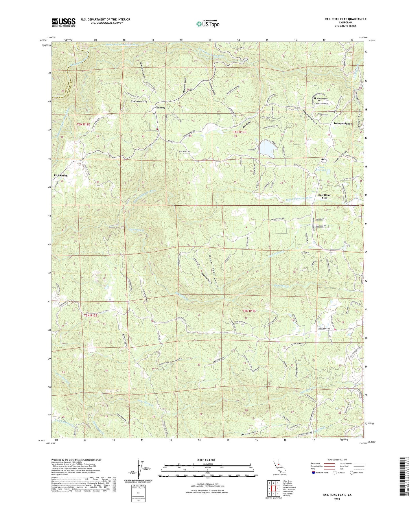
2021 topographic map quadrangle Rail Road Flat in the state of California. Scale: 1:24000. Based on the newly updated USGS 7.5' US Topo map series, this map is in the following counties: Calaveras, Amador. The map contains contour data, water features, and other items you are used to seeing on USGS maps, but also has updated roads and other features. This is the next generation of topographic maps. Printed on high-quality waterproof paper with UV fade-resistant inks.
Quads adjacent to this one:
West: Mokelumne Hill
Northwest: Pine Grove
North: West Point
Northeast: Devils Nose
East: Fort Mountain
Southeast: Murphys
South: Calaveritas
Southwest: San Andreas
This map covers the same area as the classic USGS quad with code o38120c5.
Contains the following named places: Alabama Hill, Central Calaveras Fire and Rescue Protection District Station 1 Headquarters, Central Calaveras Fire and Rescue Protection District Station 4, Clark Reservoir, Esperanza Creek, Etna Mine, Glencoe, Glencoe Post Office, Hazel Dell Gulch, Humbug Gulch, Independence, Independence Cemetery, Independence Gulch, Jack Nelson Creek, Jeff Davis 82-004 Dam, Jeff Davis Mine, Licking Fork, Mexican Gulch, Middle Fork Mokelumne River, Mosquito Gulch, North Fork Mokelumne River, Paramae Gulch, Rail Road Flat, Rail Road Flat Census Designated Place, Rail Road Flat Elementary School, Rail Road Flat Post Office, Rindge Mine Number One, Rindge Mine Number Three, Salamander Creek, South Fork Mokelumne River, Spring Gulch, Spruce Gulch, Two Dollar Gulch, Valentine Gulch, Victory Dude Ranch, Wet Gulch, ZIP Code: 95232