MyTopo
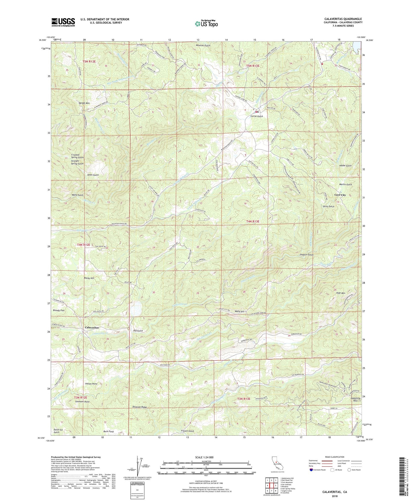
Calaveritas California US Topo Map
Couldn't load pickup availability
2021 topographic map quadrangle Calaveritas in the state of California. Scale: 1:24000. Based on the newly updated USGS 7.5' US Topo map series, this map is in the following counties: Calaveras. The map contains contour data, water features, and other items you are used to seeing on USGS maps, but also has updated roads and other features. This is the next generation of topographic maps. Printed on high-quality waterproof paper with UV fade-resistant inks.
Quads adjacent to this one:
West: San Andreas
Northwest: Mokelumne Hill
North: Rail Road Flat
Northeast: Fort Mountain
East: Murphys
Southeast: Columbia
South: Angels Camp
Southwest: Salt Spring Valley
This map covers the same area as the classic USGS quad with code o38120b5.
Contains the following named places: Adobe Gulch, Barnhardt Mine, Bence Mine, Black Spring Creek, Blue Eagle Mine, Bone Hard Mine, Bosco Mine, Buck Field, Bund Mine, Calaveras County, Calaveritas, Calaveritas Hill Consolidated Mine, Cave City, Central Calaveras Fire and Rescue Protection District Station 3, Chaparral Mine, Corral Gulch, Cotton Flat Mine, Crooked Spring Gulch, Department of Forestry and Fire Protection Esperanza, Dirty Gulch, Dogtown, Donovan Ridge, Economic Mine, Eldorado Creek, Emery 491 Dam, Emery Reservoir, Esmeralda Mine, Esmeralda School, Esperanza Fire Control Station, Foley Mine, French Gulch, Fricot Ranch School, Friendship Mine, Gaston Hill Mine, Gum Boot Mine, Hidden Cave Mine, High Mountain, Humboldt Mine, Indian Creek, Italian Point, Janes Gulch, Joaquin Gulch, Lucky Jim Mine, Martin Gulch, McKinney Creek, Mountain Ranch, Mountain Ranch Cemetery, Mountain Ranch Census Designated Place, Mountain Ranch Lutheran Church, Mountain Ranch Mine, Mountain Ranch Post Office, New Orleans Mine, North Fork Willow Creek, Old Gulch, O'Neil Creek, Oro Fino Mine, Quarry Four, Quiggs Mountain, Railroad Hill Mine, Richie Hill Mine, Rocky Hill, Rose Hill Mine, San Antonio Camp, Sierra Vista Lookout, Simmons Point, Soapstone Hill, South Fork Willow Creek, Starlite Mine, Straight Spring Gulch, Sunset Mine, Thomas Brothers Mine, Walla Gulch, Wally Hill, Wet Prong Salamander Creek, Zwinge Ranch, ZIP Code: 95246