MyTopo
Pine Grove California US Topo Map
Couldn't load pickup availability
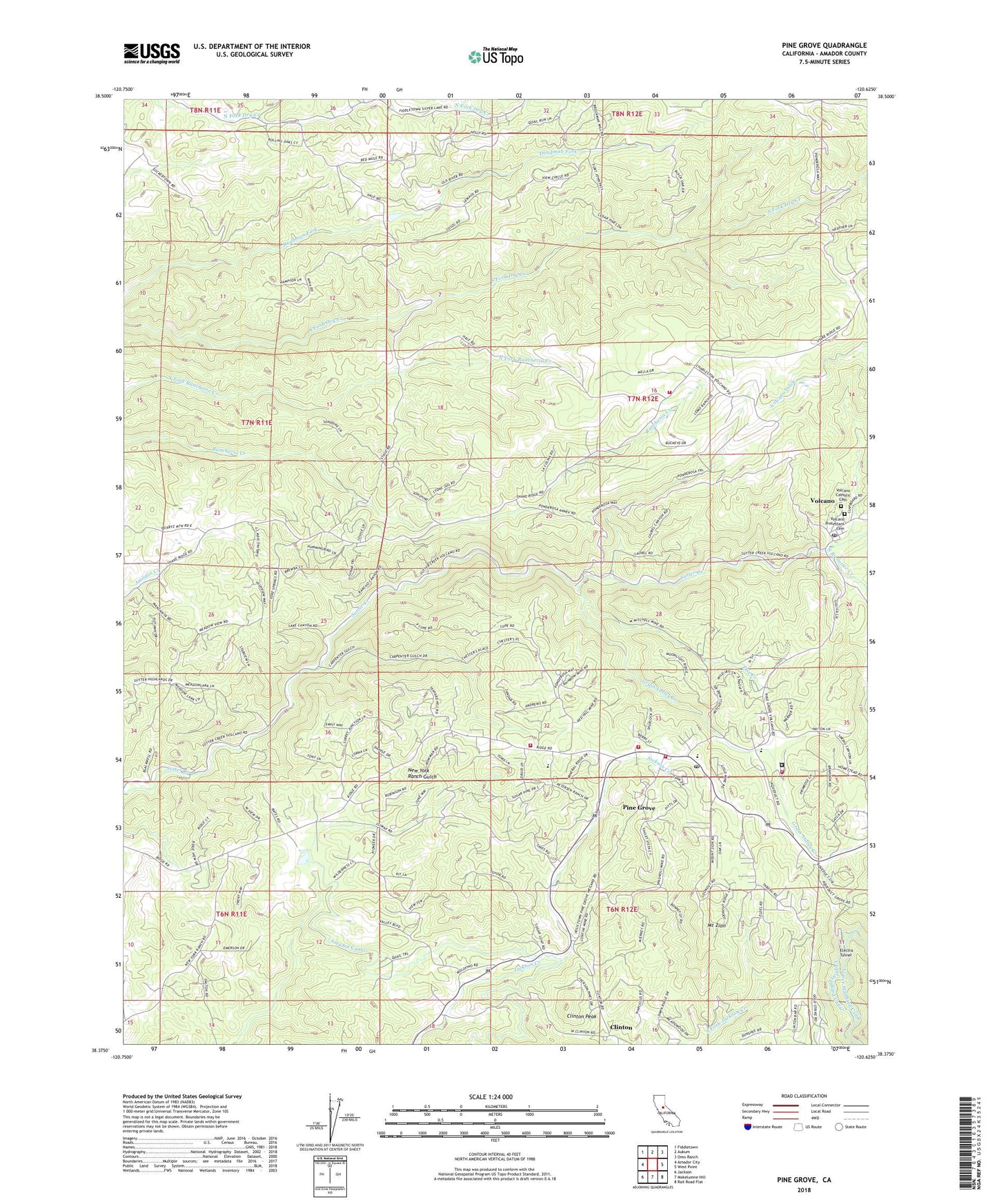
2021 topographic map quadrangle Pine Grove in the state of California. Scale: 1:24000. Based on the newly updated USGS 7.5' US Topo map series, this map is in the following counties: Amador. The map contains contour data, water features, and other items you are used to seeing on USGS maps, but also has updated roads and other features. This is the next generation of topographic maps. Printed on high-quality waterproof paper with UV fade-resistant inks.
Quads adjacent to this one:
West: Amador City
Northwest: Fiddletown
North: Aukum
Northeast: Omo Ranch
East: West Point
Southeast: Rail Road Flat
South: Mokelumne Hill
Southwest: Jackson
This map covers the same area as the classic USGS quad with code o38120d6.
Contains the following named places: Amador Canal, Amador County, Amador Fire Protection District Station 114, Amador Fire Protection District Station 115, American Legion Ambulance Station 4, Aqueduct City Cemetery, Armory Hall, California Department of Forestry and Fire Protection Pine Grove Fire Station 80, California Youth Authority, Chaw'se Regional Indian Museum, Clinton, Clinton Peak, Clute Building, Department of Forestry and Fire Protection Pine Grove Conservation, Else Creek, Fort Ann Mine, Grass Valley Creek, Helbing Ranch, Indian Grinding Rock State Historic Park, Irishtown, Jackson Rancheria, Lockwood Fire Protection District Station 152, Mount Zion, Mount Zion State Forest, New York Ranch School, North Trail, Oneto Ranch, Pine Acres, Pine Grove, Pine Grove Cemetery, Pine Grove Census Designated Place, Pine Grove Community Church, Pine Grove Forestry Camp, Pine Grove Park, Pine Grove Post Office, Pine Grove Stem Magnet Elementary School, Pine Grove Town Hall, Rancheria, Saint Bernards Catholic Church, Soldiers Memorial Park, South Branch Sutter Creek, South Nature Trail, U'macha'tam'ma Environmental Campsites, Volcano, Volcano Catholic Cemetery, Volcano Jail House, Volcano Post Office, Volcano Protestant Cemetery, Volcano School, Zion California Department of Forestry Station, ZIP Code: 95665