MyTopo
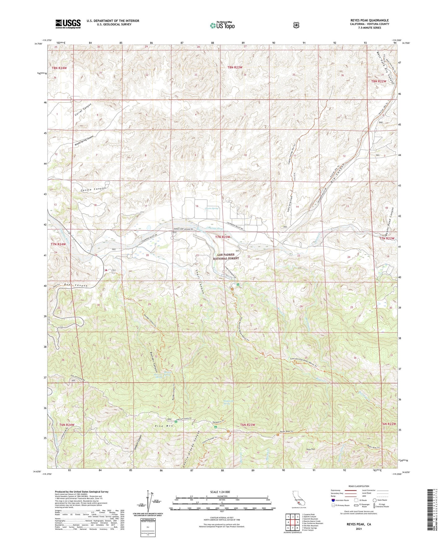
Reyes Peak California US Topo Map
Couldn't load pickup availability
Also explore the Reyes Peak Forest Service Topo of this same quad for updated USFS data
2021 topographic map quadrangle Reyes Peak in the state of California. Scale: 1:24000. Based on the newly updated USGS 7.5' US Topo map series, this map is in the following counties: Ventura. The map contains contour data, water features, and other items you are used to seeing on USGS maps, but also has updated roads and other features. This is the next generation of topographic maps. Printed on high-quality waterproof paper with UV fade-resistant inks.
Quads adjacent to this one:
West: Rancho Nuevo Creek
Northwest: Cuyama Peak
North: Apache Canyon
Northeast: Sawmill Mountain
East: San Guillermo Mountain
Southeast: Lion Canyon
South: Wheeler Springs
Southwest: Old Man Mountain
This map covers the same area as the classic USGS quad with code o34119f3.
Contains the following named places: Alamo Creek, Bear Canyon, Beartrap Creek, Beartrap Number 1 Campsite, Beartrap Number One Campground, Beartrap Number Two Campground, Boulder Canyon, Camp Scheideck, Castle Canyon, Chorro Spring, Chorro Springs Campground, Dry Canyon, Los Padres National Forest, McGuire Spring, McGuire Spring Rustic Campsite, McGuire Trail, McGurie Spring, Ozena Campground, Ozena Guard Station, Ozena Recreation Site, Pine Mountain, Pine Mountain Campground, Raspberry rustic Campsite, Raspberry Spring, Reyes Campground, Reyes Creek, Reyes Creek Campground, Reyes Peak, Reyes Peak Campground, Snail Canyon, Sulphur Spring Canyon, United States Forest Service Los Padres National Forest Station 72 Ozena, Upper Reyes Campground, Wagon Road Canyon, West Fork Dry Canyon