MyTopo
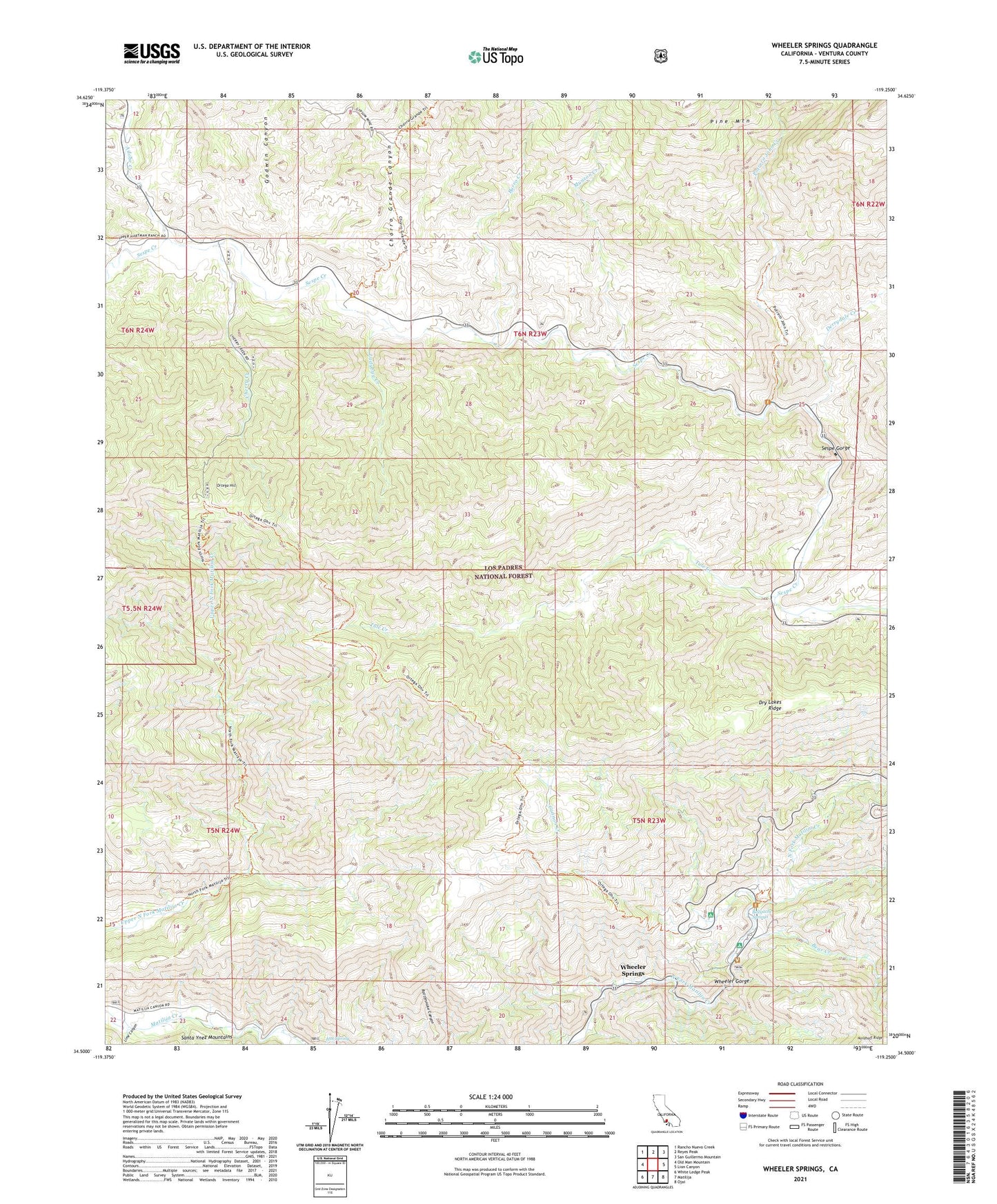
Wheeler Springs California US Topo Map
Couldn't load pickup availability
2021 topographic map quadrangle Wheeler Springs in the state of California. Scale: 1:24000. Based on the newly updated USGS 7.5' US Topo map series, this map is in the following counties: Ventura. The map contains contour data, water features, and other items you are used to seeing on USGS maps, but also has updated roads and other features. This is the next generation of topographic maps. Printed on high-quality waterproof paper with UV fade-resistant inks.
Quads adjacent to this one:
West: Old Man Mountain
Northwest: Rancho Nuevo Creek
North: Reyes Peak
Northeast: San Guillermo Mountain
East: Lion Canyon
Southeast: Ojai
South: Matilija
Southwest: White Ledge Peak
This map covers the same area as the classic USGS quad with code o34119e3.
Contains the following named places: Adobe Creek, Bear Creek, Bellyache Springs, Burro Creek, Cannon Creek, Cherry Creek, Cherry Creek Campground, Cherry Creek Campsite, Chorro Grande Canyon, Chorro Grande Trail, Derrydale Creek, Dry Lakes Ridge, Felt Ranch, Godwin Canyon, Hartman Ranch, Holiday Camp, Holiday Group Campground, Ladybug Creek, Lime Canyon, Maple Campground, Maple Campsite, Middle Matilija Campground, Middle Matilija Campsite, Munson Creek, Oak Camp, Oak Campsite, Ortega Campground, Ortega Campsite, Ortega Hill, Ortega Rustic Campsite, Ortega Trail, Pine Mountain Inn, Potrero John Campground, Potrero John Campsite, Potrero John Creek, Sandstone Camp, Sespe Gorge, Tule Creek, Upper Matilija Campground, Wheeler Gorge, Wheeler Gorge Campground, Wheeler Gorge Fire Station, Wheeler Springs, ZIP Code: 93023