MyTopo
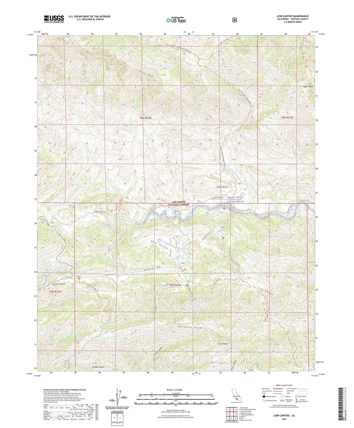
Lion Canyon California US Topo Map
Couldn't load pickup availability
Also explore the Lion Canyon Forest Service Topo of this same quad for updated USFS data
2021 topographic map quadrangle Lion Canyon in the state of California. Scale: 1:24000. Based on the newly updated USGS 7.5' US Topo map series, this map is in the following counties: Ventura. The map contains contour data, water features, and other items you are used to seeing on USGS maps, but also has updated roads and other features. This is the next generation of topographic maps. Printed on high-quality waterproof paper with UV fade-resistant inks.
Quads adjacent to this one:
West: Wheeler Springs
Northwest: Reyes Peak
North: San Guillermo Mountain
Northeast: Lockwood Valley
East: Topatopa Mountains
Southeast: Santa Paula Peak
South: Ojai
Southwest: Matilija
This map covers the same area as the classic USGS quad with code o34119e2.
Contains the following named places: Beaver Camp, Beaver Campground, Chief Peak, Circle B Ranch, East Fork Lion Camp, Gore Ranch, Gridley Trail, Howard Creek, Howard Creek Camp, Lion Campground, Lion Canyon, Lower Rose Lake, Middle Lion Campground, Middle Sespe Trail, Nordhoff Ridge, North Fork Piedra Blanca Creek, Ojai Valley Gun Club, Piedra Blanca, Piedra Blanca Camp, Piedra Blanca Campsite, Piedra Blanca Civilian Conservation Corps Camp, Piedra Blanca Creek, Pine Mountain Camp, Pine Mountain Lodge, Pine Mountain Lodge Campsite, Pollard Point, Rancho Grande, Rock Creek, Rose Lion Trail, Rose Valley, Rose Valley Campground, Rose Valley Creek, Rose Valley Falls, Rose Valley Falls Camp, Rose Valley Station, Thacher Cabin, Thorn Point, Three Mile Campground, Three Mile Campsite, Trout Creek, Twin Forks Camp, Twin Forks Campsite, Upper Rose Lake, West Fork Lion Camp