MyTopo
Richardson Springs NW California US Topo Map
Couldn't load pickup availability
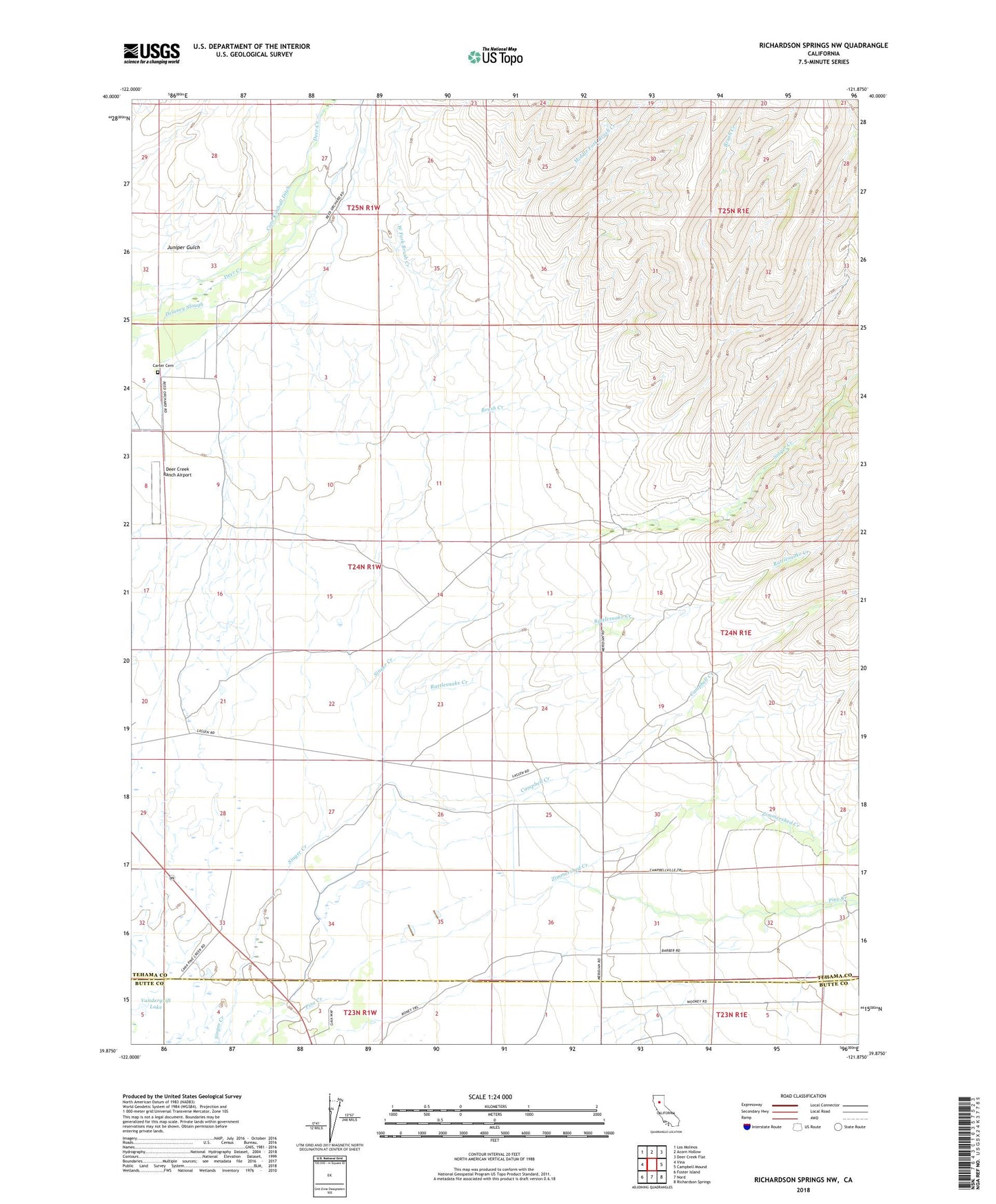
2022 topographic map quadrangle Richardson Springs NW in the state of California. Scale: 1:24000. Based on the newly updated USGS 7.5' US Topo map series, this map is in the following counties: Tehama, Butte. The map contains contour data, water features, and other items you are used to seeing on USGS maps, but also has updated roads and other features. This is the next generation of topographic maps. Printed on high-quality waterproof paper with UV fade-resistant inks.
Quads adjacent to this one:
West: Vina
Northwest: Los Molinos
North: Acorn Hollow
Northeast: Deer Creek Flat
East: Campbell Mound
Southeast: Richardson Springs
South: Nord
Southwest: Foster Island
This map covers the same area as the classic USGS quad with code o39121h8.
Contains the following named places: Bell Ranch, Brush Creek, Campbell Creek, Carter Cemetery, Cone Kimball Ditch, Deer Creek Flat Trail, Deer Creek Irrigation Ditch, Deer Creek Ranch Airport, Juniper Gulch, Live Oak School, McKenzie Ranch, Middle Fork Brush Creek, Rattlesnake Creek, Stephens Ranch, Vandergrift Lake, West Fork Brush Creek, Zimmershed Creek