MyTopo
Campbell Mound California US Topo Map
Couldn't load pickup availability
Also explore the Campbell Mound Forest Service Topo of this same quad for updated USFS data
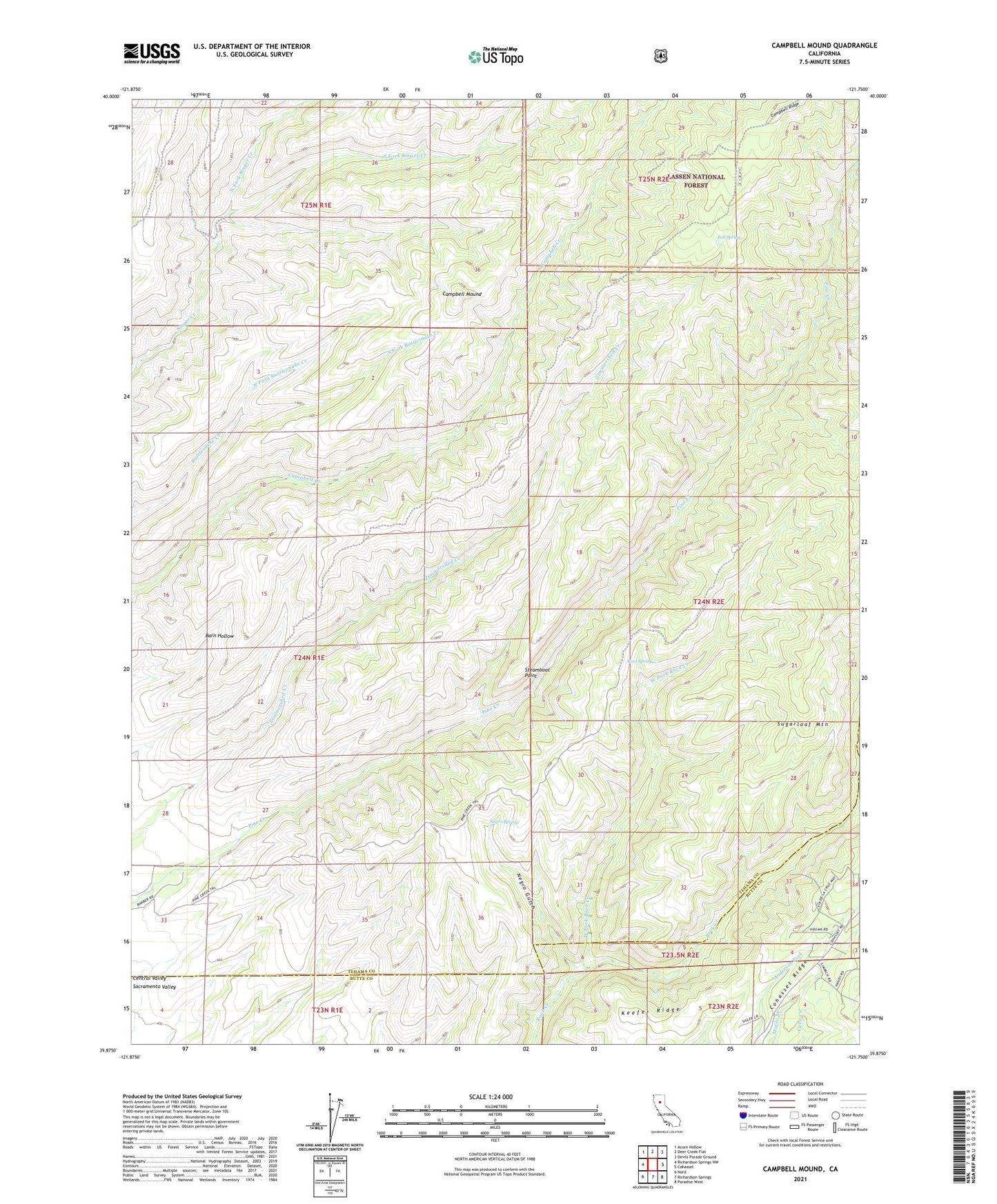
2021 topographic map quadrangle Campbell Mound in the state of California. Scale: 1:24000. Based on the newly updated USGS 7.5' US Topo map series, this map is in the following counties: Tehama, Butte. The map contains contour data, water features, and other items you are used to seeing on USGS maps, but also has updated roads and other features. This is the next generation of topographic maps. Printed on high-quality waterproof paper with UV fade-resistant inks.
Quads adjacent to this one:
West: Richardson Springs NW
Northwest: Acorn Hollow
North: Deer Creek Flat
Northeast: Devils Parade Ground
East: Cohasset
Southeast: Paradise West
South: Richardson Springs
Southwest: Nord
This map covers the same area as the classic USGS quad with code o39121h7.
Contains the following named places: Baccala Cabin, Barn Hollow, Bell Cabin, Bell Spring, Burroughs Pinery, Campbell Mound, Campbellville Trail, Franks Cabin, Negro Gulch, Negro Spring, North Fork Rattlesnake Creek, North Fork Singer Creek, Pine Creek Trail, Root Spring, South Fork Rattlesnake Creek, South Fork Singer Creek, Steamboat Point, Sugarloaf Mountain, West Fork Rock Creek, ZIP Code: 95973