MyTopo
Acorn Hollow California US Topo Map
Couldn't load pickup availability
Also explore the Acorn Hollow Forest Service Topo of this same quad for updated USFS data
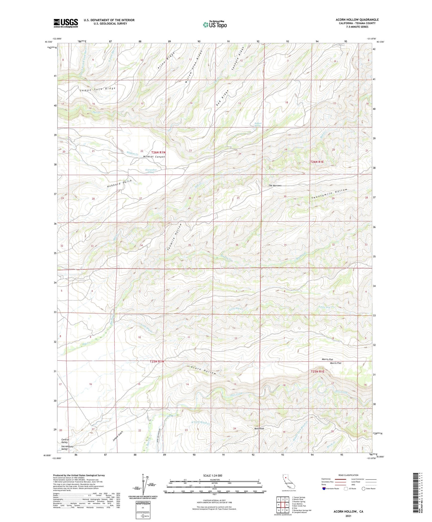
2021 topographic map quadrangle Acorn Hollow in the state of California. Scale: 1:24000. Based on the newly updated USGS 7.5' US Topo map series, this map is in the following counties: Tehama. The map contains contour data, water features, and other items you are used to seeing on USGS maps, but also has updated roads and other features. This is the next generation of topographic maps. Printed on high-quality waterproof paper with UV fade-resistant inks.
Quads adjacent to this one:
West: Los Molinos
Northwest: Tuscan Springs
North: Dewitt Peak
Northeast: Panther Spring
East: Deer Creek Flat
Southeast: Campbell Mound
South: Richardson Springs NW
Southwest: Vina
This map covers the same area as the classic USGS quad with code o40121a8.
Contains the following named places: Apperson Cabin, Bald Knob, Ballard Spring, Big Dry Creek, Carmichael Rock Quarry, Delay Camp, Favinger Place, Hobson Camp, Horseshoe Pond, Lee Camp, Little Dry Creek, Little Mill Creek, Little North Fork North Fork Dye Creek, Magnuson Cabin, Morris Flat, Ruffin Cabin, Tenmile, Tenmile Hollow, The Narrows, Twentymile Hollow