
MyTopo
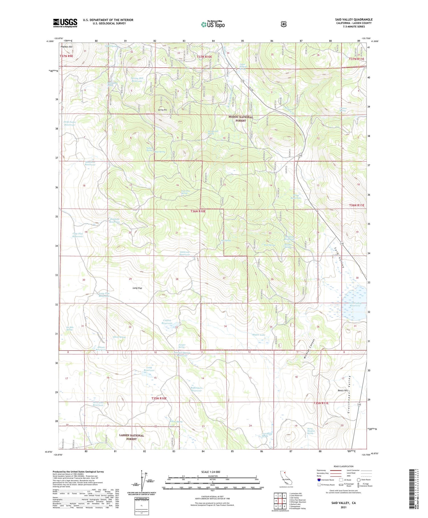
Said Valley California US Topo Map
Couldn't load pickup availability
Also explore the Said Valley Forest Service Topo of this same quad for updated USFS data
2021 topographic map quadrangle Said Valley in the state of California. Scale: 1:24000. Based on the newly updated USGS 7.5' US Topo map series, this map is in the following counties: Lassen. The map contains contour data, water features, and other items you are used to seeing on USGS maps, but also has updated roads and other features. This is the next generation of topographic maps. Printed on high-quality waterproof paper with UV fade-resistant inks.
Quads adjacent to this one:
West: Silva Flat Reservoir
Northwest: Letterbox Hill
North: Lane Reservoir
Northeast: Ash Valley
East: Whitinger Mountain
Southeast: Grasshopper Valley
South: Sheepshead
Southwest: Bullard Lake
This map covers the same area as the classic USGS quad with code o40120h7.
Contains the following named places: Abbott Reservoir, Abbott Spring, Acre Foot Reservoir, Ambrose Reservoir, Boffengers Reservoir, Bosco Hill, Box Spring, Catfish Reservoir, Chicken Spring, Clay Flat Reservoir, Coon Camp Spring, Dago Spring, Daisy Dean Spring, Drift Fence Reservoir, Four Pine Spring, Grasshopper Valley, Hatfield Reservoir, Hayden Hill, Hazelton Reservoir, Hencratt Camp, Horse Meadow, Horse Meadow Spring, Indian Spring, Italian Spring, Johnson Camp, Juniper Spring, Juniper Spring Reservoir, Long Flat, Long Flat Reservoir, Long Reservoir, Mapes Lake, Rock Spring, Said Valley, Said Valley Reservoir, Six Mile Spring, Spring Hill, Spring Hill Reservoir, Spring Hill Spring, Stratton Reservoir, Stratton Spring, Totten Camp, Upper McBride Spring, Walton Meadow, West Fork Willow Creek, Wildcat Canyon, Willow Spring, Wing Reservoir


