MyTopo
Letterbox Hill California US Topo Map
Couldn't load pickup availability
Also explore the Letterbox Hill Forest Service Topo of this same quad for updated USFS data
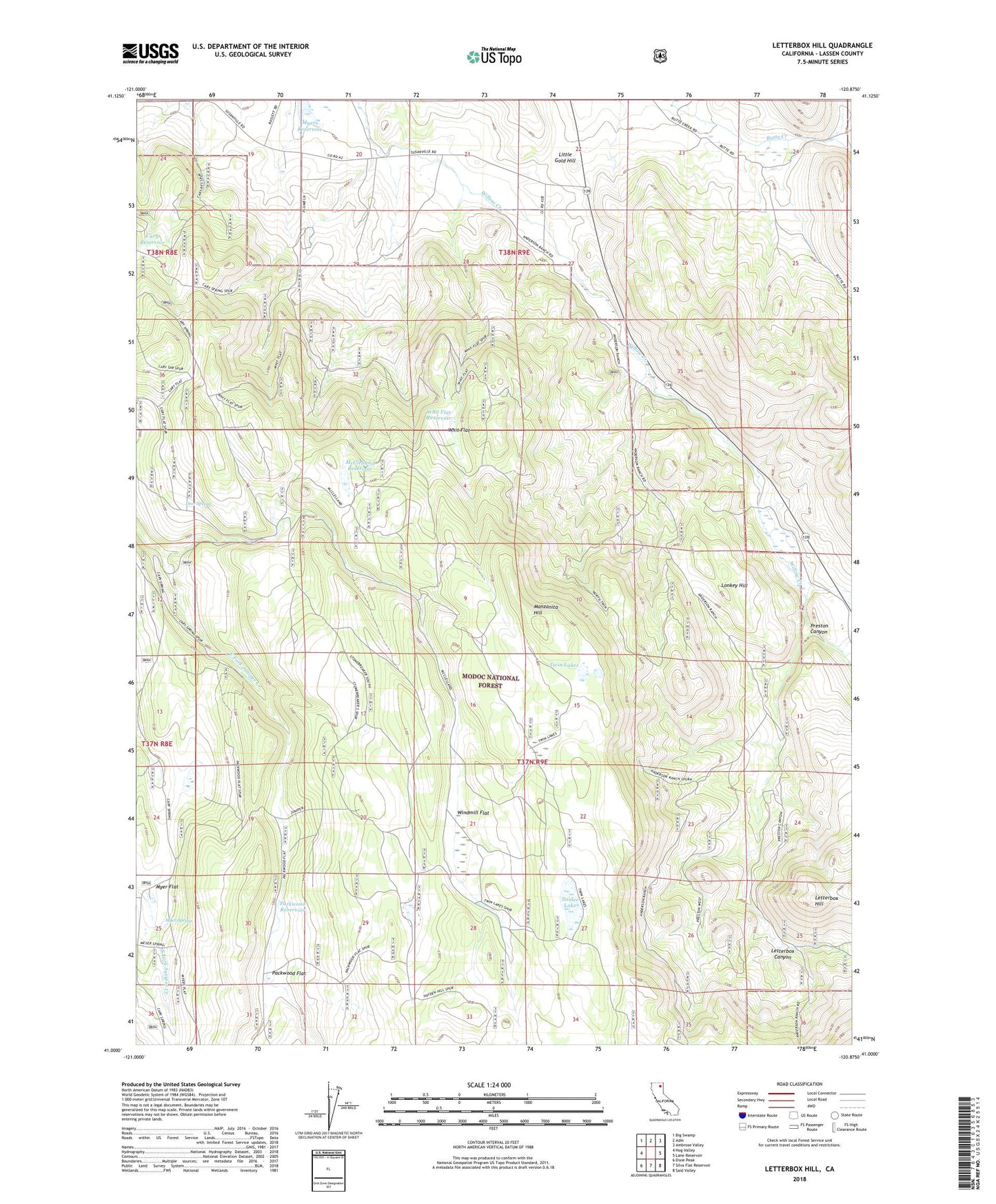
2021 topographic map quadrangle Letterbox Hill in the state of California. Scale: 1:24000. Based on the newly updated USGS 7.5' US Topo map series, this map is in the following counties: Lassen. The map contains contour data, water features, and other items you are used to seeing on USGS maps, but also has updated roads and other features. This is the next generation of topographic maps. Printed on high-quality waterproof paper with UV fade-resistant inks.
Quads adjacent to this one:
West: Hog Valley
Northwest: Big Swamp
North: Adin
Northeast: Ambrose Valley
East: Lane Reservoir
Southeast: Said Valley
South: Silva Flat Reservoir
Southwest: Dixie Peak
This map covers the same area as the classic USGS quad with code o41120a8.
Contains the following named places: Cary Reservoir, Deer Spring, Hayden Hill-Silva Flat State Game Refuge, Knudsen Ranch, Letterbox Canyon, Letterbox Hill, Little Gold Hill, Lonkey Hill, Manzanita Hill, McClelland Reservoir, Myer Flat, Myer Spring, Packwood Flat, Packwood Reservoir, Preston Canyon, Snider Lake, Stonebreaker Crossing, Twin Lakes, Whit Flat, Whit Flat Reservoir, Windmill Flat