MyTopo
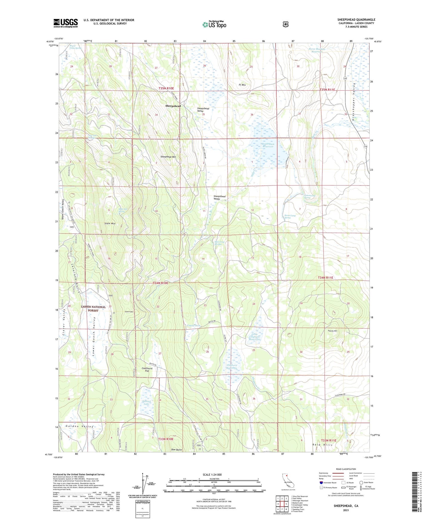
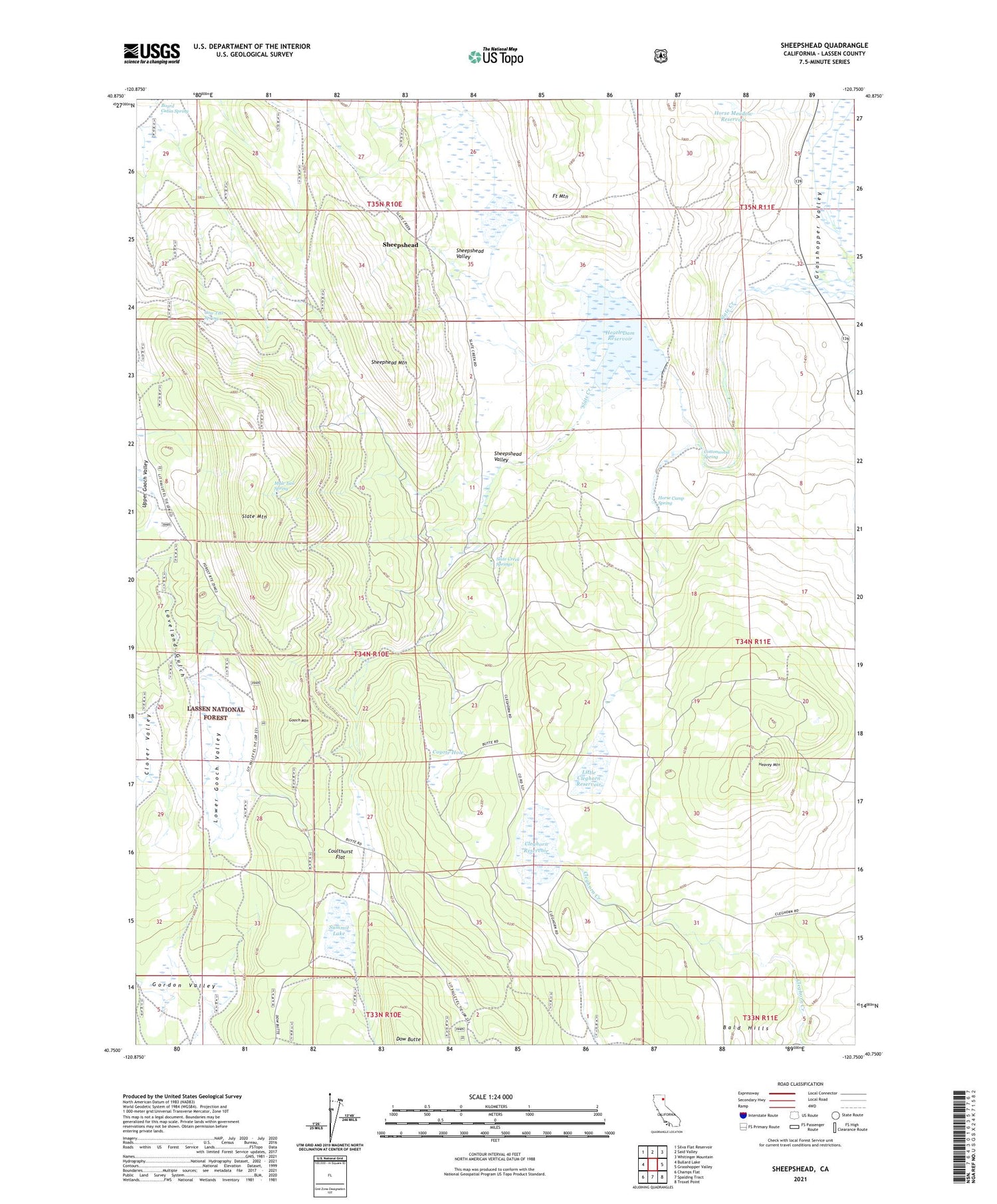
Sheepshead California US Topo Map
Couldn't load pickup availability
Also explore the Sheepshead Forest Service Topo of this same quad for updated USFS data
2021 topographic map quadrangle Sheepshead in the state of California. Scale: 1:24000. Based on the newly updated USGS 7.5' US Topo map series, this map is in the following counties: Lassen. The map contains contour data, water features, and other items you are used to seeing on USGS maps, but also has updated roads and other features. This is the next generation of topographic maps. Printed on high-quality waterproof paper with UV fade-resistant inks.
Quads adjacent to this one:
West: Bullard Lake
Northwest: Silva Flat Reservoir
North: Said Valley
Northeast: Whitinger Mountain
East: Grasshopper Valley
Southeast: Troxel Point
South: Spalding Tract
Southwest: Champs Flat
This map covers the same area as the classic USGS quad with code o40120g7.
Contains the following named places: Board Burn, Board Cabin Spring, Cleghorn Reservoir, Cottonwood Spring, Coulthurst Flat, Cow Tail Spring, Coyote Hole, Fort Mountain, Gooch Camp, Gooch Mountain, Heath Dam Reservoir, Heath Reservoir 250-004 Dam, Heavey Mountain, Horse Camp Spring, Horse Meadow Reservoir, Indian Well, Little Cleghorn Reservoir, Loveland Gulch, Lower Gooch Valley, Mule Tail Spring, Sheephead Mountain, Sheepshead, Sheepshead Valley, Slate Creek Springs, Slate Mountain, Summit Lake, Swanberger Reservoir, Upper Gooch Valley