MyTopo
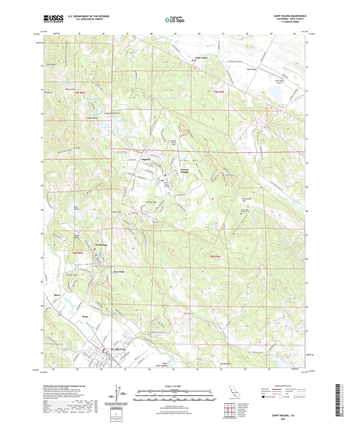
Saint Helena California US Topo Map
Couldn't load pickup availability
2021 topographic map quadrangle Saint Helena in the state of California. Scale: 1:24000. Based on the newly updated USGS 7.5' US Topo map series, this map is in the following counties: Napa. The map contains contour data, water features, and other items you are used to seeing on USGS maps, but also has updated roads and other features. This is the next generation of topographic maps. Printed on high-quality waterproof paper with UV fade-resistant inks.
Quads adjacent to this one:
West: Calistoga
Northwest: Detert Reservoir
North: Aetna Springs
Northeast: Walter Springs
East: Chiles Valley
Southeast: Yountville
South: Rutherford
Southwest: Kenwood
Contains the following named places: Angqin Plaza Shopping Center, Angwin, Angwin 2419 Dam, Angwin Census Designated Place, Angwin Division, Angwin Post Office, Angwin Volunteer Community Ambulance, Angwin Volunteer Fire Department, Angwin-Parrett Field, Barro, Bell Canyon, Bell Canyon Dam, Bell Canyon Reservoir, Bell Valley, Beringer Brothers Winery, Bradley Young Observatory, Buehler Vineyards, Burgess Cellars, Candlestick Ridge, Canon Creek, Casa Nuestra Winery, Catacoula 411 Dam, Central School, Charles Krug Winery, Chateau Boswell Winery, Christian Brothers Winery, City of Saint Helena, Conn Valley, Cooksley Lake, Crystal 410 Dam, Crystal Dam, Deer Lake, Deer Lake 413-005 Dam, Deer Park, Deer Park Census Designated Place, Deer Park Post Office, Derr Park Winery, Doe Lake, Duckhorn Vineyards, Elmshaven, Fawn Lake, Foothills Adventist Elementary School, Freemark Abbey Winery, Glass Mountain, Granite Lake, Hardin School, Heitz Wine Cellars, Henne 413-004 Dam, Howell Mountain, Howell Mountain Elementary School, Inspiration Point, Italian Valley, Joseph Phelps Vineyards, Krug, La Herradura 415 Dam, La Jota, Lake Ellen, Lake Henne, Lake Newton, Lake Orville, Lake Whitehead, Las Posadas Pioneer Cemetery, Las Posadas State Forest, Linda Falls, Locoallomi, Lookout Point, Markham Winery, Martin Spring, Meadowood Golf Club, Merritt B Pratt Pool, Mill Creek, Mill Valley, Napa County Fire Department Station 20 Pope Valley, Napa County Fire Department Station 21 Deer Park, Napa County Fire Department Station 30 Las Posadas, Napa County Sheriff's Office Angwin Regional Office, Napa Creek Winery, Newton 413 Dam, Newton Observatory, Orville 413-006 Dam, Pacific Auditorium, Pacific Union College, Pacific Union College Elementary School, Pope Street Bridge, Pope Valley, Pope Valley Airport, Pope Valley Elementary School, Pope Valley Post Office, Pope Valley Winery, Pratt Valley, Rancho La Jota 2414 Dam, Rattlesnake Ridge, Recreation Flat, Red Lake, Red Lake 413-002 Dam, Robert Louis Stevenson Intermediate School, Round Hill Cellars, Saint Clement Vineyards, Saint Helena, Saint Helena Catholic Church, Saint Helena Catholic School, Saint Helena City Hall, Saint Helena Elementary School, Saint Helena Fire Department, Saint Helena Hospital Napa Valley, Saint Helena Lower 16-002 Dam, Saint Helena Police Department, Saint Helena Post Office, Saint Helena Public Library, Saint Helena Water Treatment Plant, Sanitarium, Sentinel Hill, Silverado Museum, Spring Valley, Stonesbridge Park, Sulphur Creek, Sunset Point, The Beehive, The California Meadery, Three Peaks, Uncle John Creek, Usibelli Number 2 2413-002 Dam, Veteran Heights, Vineyard Valley Mobile Home Park, W E Nelson Memorial Library, Walnut Flat, White Head 413-003 Dam, Wild Lake, Wildcat Canyon, York Creek, ZIP Codes: 94508, 94574, 94576


