MyTopo
Chiles Valley California US Topo Map
Couldn't load pickup availability
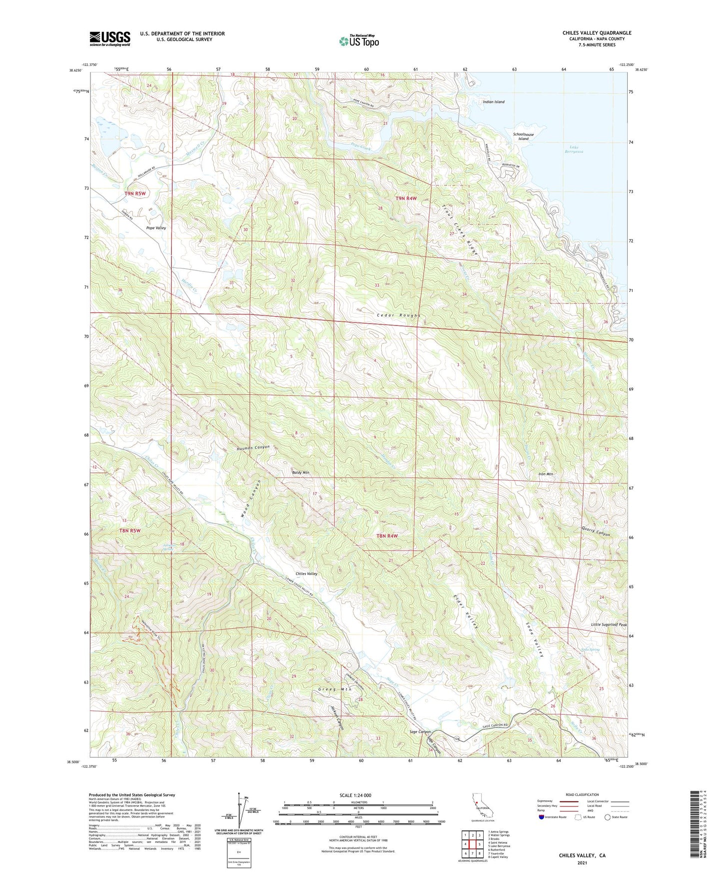
2021 topographic map quadrangle Chiles Valley in the state of California. Scale: 1:24000. Based on the newly updated USGS 7.5' US Topo map series, this map is in the following counties: Napa. The map contains contour data, water features, and other items you are used to seeing on USGS maps, but also has updated roads and other features. This is the next generation of topographic maps. Printed on high-quality waterproof paper with UV fade-resistant inks.
Quads adjacent to this one:
West: Saint Helena
Northwest: Aetna Springs
North: Walter Springs
Northeast: Brooks
East: Lake Berryessa
Southeast: Capell Valley
South: Yountville
Southwest: Rutherford
This map covers the same area as the classic USGS quad with code o38122e3.
Contains the following named places: Baldy Mountain, Burton Creek, Catacula, Cedar Roughs, Cedar Roughs Wilderness, Chiles Grist Mill, Chiles Valley, Chiles Valley School, Elder Valley, Greeg Mountain, Green and Red Vineyard, Hardin Creek, Husman Canyon, Indian Island, Iron Mountain, Jackson Canyon, Johnson Spring, Lake Berryessa Seaplane Base, Linda Vista 2412 Dam, Little Sugarloaf Peak, Moore Creek, Napa County, Nichelini Winery, Pope Creek, Putah Creek Park, Rancho Monticello, Robert L Matheson 1413 Dam, Samuel Springs, Schoolhouse Island, Smittle Creek, Soda Spring, Trout Creek, Trout Creek Ridge, Wood Canyon