MyTopo
San Francisco South OE W California US Topo Map
Couldn't load pickup availability
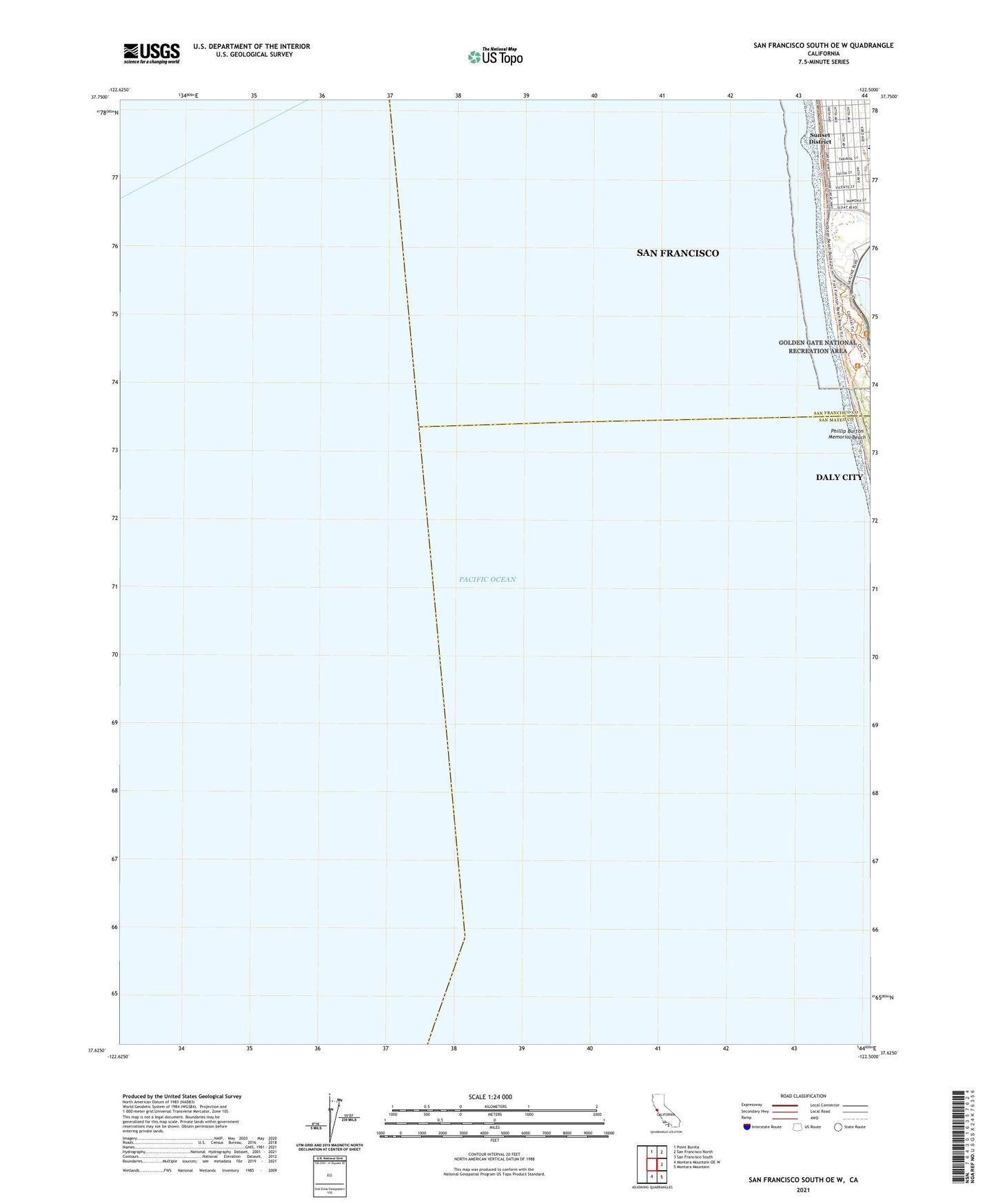
2021 topographic map quadrangle San Francisco South OE W in the state of California. Scale: 1:24000. Based on the newly updated USGS 7.5' US Topo map series, this map is in the following counties: San Mateo, San Francisco. The map contains contour data, water features, and other items you are used to seeing on USGS maps, but also has updated roads and other features. This is the next generation of topographic maps. Printed on high-quality waterproof paper with UV fade-resistant inks.
Quads adjacent to this one:
North: Point Bonita
Northeast: San Francisco North
East: San Francisco South
Southeast: Montara Mountain
South: Montara Mountain OE W
Contains the following named places: Bay High School, Fleishhacker Zoo, Independence High School, Nike Site SF-59L, Oceanside Water Pollution Control Plant, Phillip Burton Memorial Beach