MyTopo
San Luis Ranch California US Topo Map
Couldn't load pickup availability
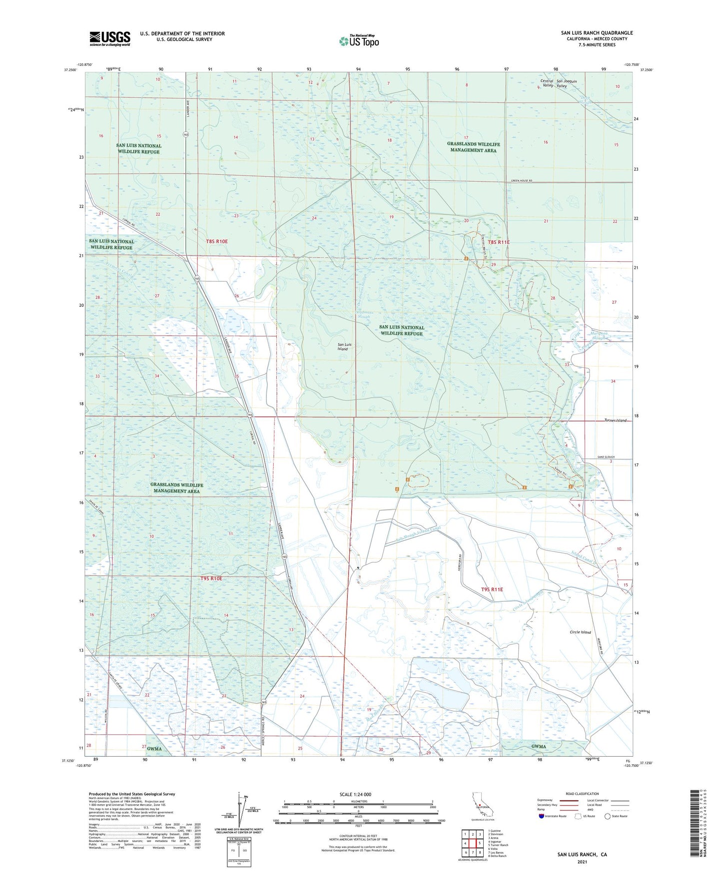
2021 topographic map quadrangle San Luis Ranch in the state of California. Scale: 1:24000. Based on the newly updated USGS 7.5' US Topo map series, this map is in the following counties: Merced. The map contains contour data, water features, and other items you are used to seeing on USGS maps, but also has updated roads and other features. This is the next generation of topographic maps. Printed on high-quality waterproof paper with UV fade-resistant inks.
Quads adjacent to this one:
West: Ingomar
Northwest: Gustine
North: Stevinson
Northeast: Arena
East: Turner Ranch
Southeast: Delta Ranch
South: Los Banos
Southwest: Volta
This map covers the same area as the classic USGS quad with code o37120b7.
Contains the following named places: Big Buttonwillow Lake, Circle Island, Circle Island Drain, Deadmans Slough, Deep Slough, Exeter Farms, Fremont Canal, Hereford Drain, Hereford Ranch, Island Canal B, Island Canal C, Island Canal D, Little Buttonwillow Lake, Los Banos State Waterfowl Area, Old Dickenson Ferry, Old Poso Slough, Salt Slough Island Canal, San Jose Gun Club, San Luis Canal, San Luis Drain Number One, San Luis Island, San Luis National Wildlife Refuge, San Luis Ranch, Santa Cruz Gun Club, Standard Gun Club, Terrels Gun Club, Underwood Gun Club, Underwood Ranch, West Delta Drain, Yellow Jacket Gun Club, Zimmerman Gun Club