MyTopo
Gustine California US Topo Map
Couldn't load pickup availability
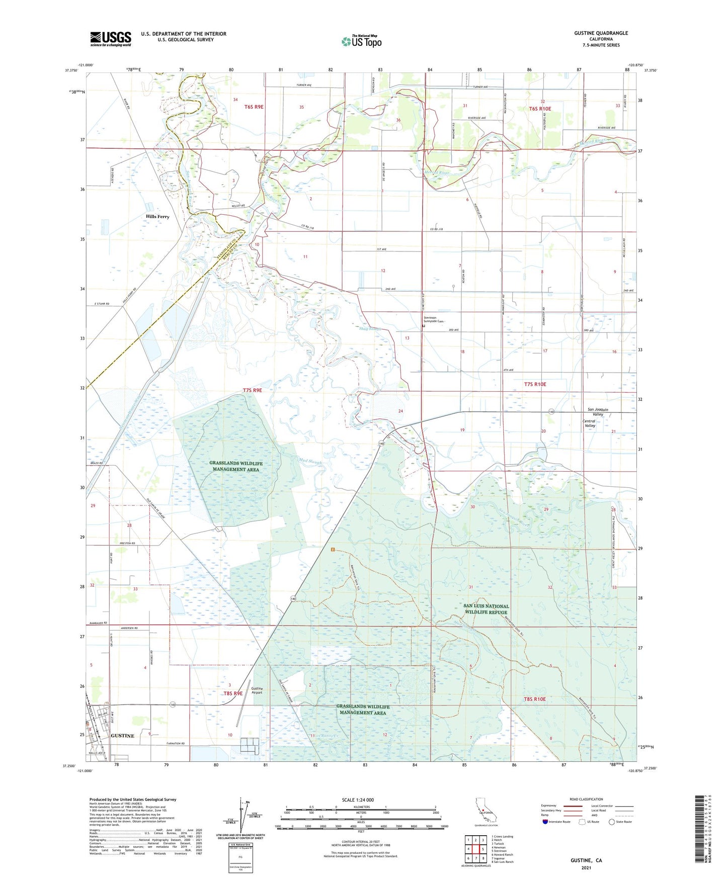
2021 topographic map quadrangle Gustine in the state of California. Scale: 1:24000. Based on the newly updated USGS 7.5' US Topo map series, this map is in the following counties: Merced, Stanislaus. The map contains contour data, water features, and other items you are used to seeing on USGS maps, but also has updated roads and other features. This is the next generation of topographic maps. Printed on high-quality waterproof paper with UV fade-resistant inks.
Quads adjacent to this one:
West: Newman
Northwest: Crows Landing
North: Hatch
Northeast: Turlock
East: Stevinson
Southeast: San Luis Ranch
South: Ingomar
Southwest: Howard Ranch
This map covers the same area as the classic USGS quad with code o37120c8.
Contains the following named places: A and D Dairy, Anchor J Dairy, Bella Vista Park, Borba Dairy Farms, City of Gustine, Dores Dairy, Fremont Ford, George J. Hatfield State Recreation Area, Great Valley Grasslands State Park, Gustine, Gustine Airport, Gustine Post Office, Hills Ferry, Hilmar-Irwin Division, Kesterson National Wildlife Refuge, Lone Tree Gun Club, Merced River, Mud Slough, Newman Gun Club, Orestimba, Outside Creek Elementary School, Pioneer Park, Salt Slough, Santa Nella Shopping Center, Shag Slough, Stevinson Home Ranch, Stevinson Sunnyside Cemetery, Valley Theatre, West End School